H46A Fife Lake, MI, USA - Earthquake Result Viewer
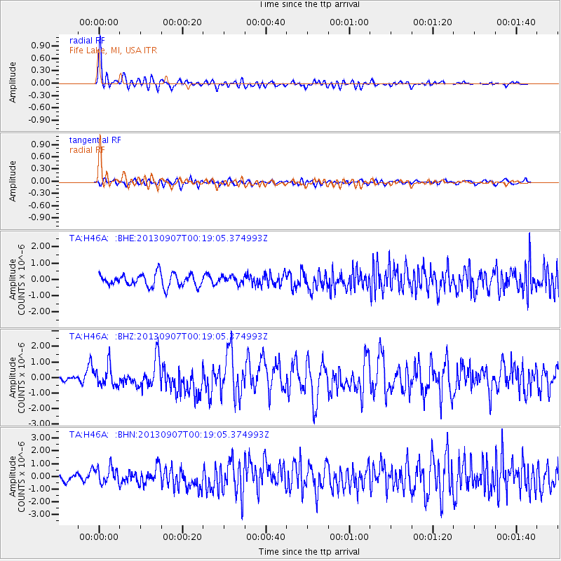
Earthquake location: Near Coast Of Chiapas, Mexico
Earthquake latitude/longitude: 14.6/-92.1
Earthquake time(UTC): 2013/09/07 (250) 00:13:29 GMT
Earthquake Depth: 66 km
Earthquake Magnitude: 6.4 MWW, 6.4 MWB, 6.4 MWC, 6.4 MWW, 6.5 MWC
Earthquake Catalog/Contributor: NEIC PDE/NEIC COMCAT
Network: TA USArray Transportable Network (new EarthScope stations)
Station: H46A Fife Lake, MI, USA
Lat/Lon: 44.54 N/85.20 W
Elevation: 329 m
Distance: 30.4 deg
Az: 9.796 deg
Baz: 193.317 deg
Ray Param: 0.07924356
Estimated Moho Depth: 15.0 km
Estimated Crust Vp/Vs: 1.67
Assumed Crust Vp: 6.483 km/s
Estimated Crust Vs: 3.888 km/s
Estimated Crust Poisson's Ratio: 0.22
Radial Match: 84.693924 %
Radial Bump: 400
Transverse Match: 52.390144 %
Transverse Bump: 400
SOD ConfigId: 626651
Insert Time: 2014-04-18 15:06:46.604 +0000
GWidth: 2.5
Max Bumps: 400
Tol: 0.001

Signal To Noise

ChannelStoNSTALTA
TA:H46A: :BHZ:20130907T00:19:05.374993Z3.44262816.5984756E-71.9166971E-7
TA:H46A: :BHN:20130907T00:19:05.374993Z3.19583686.558522E-72.0522081E-7
TA:H46A: :BHE:20130907T00:19:05.374993Z0.614479062.3408481E-73.8094842E-7
Arrivals
Ps1.7 SECOND
PpPs5.7 SECOND
PsPs/PpSs7.3 SECOND