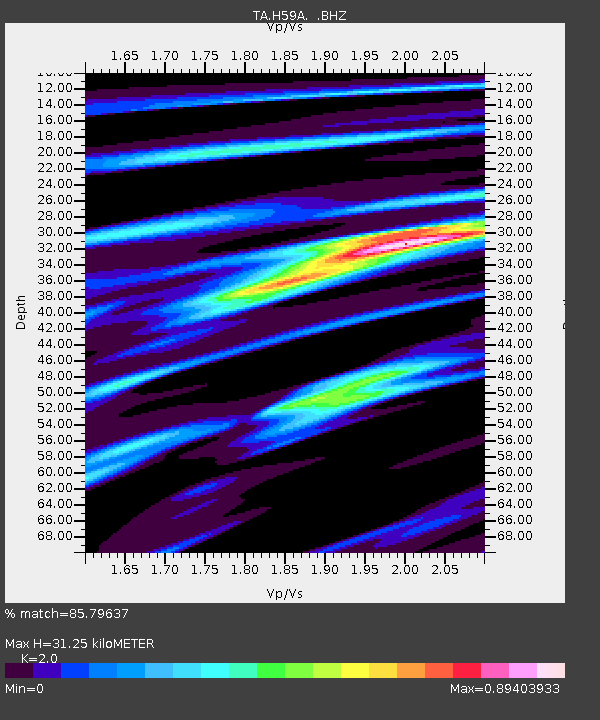
H59A Cadyville, NY, USA - Earthquake Result Viewer

Earthquake location: Near Coast Of Chiapas, Mexico
Earthquake latitude/longitude: 14.6/-92.1
Earthquake time(UTC): 2013/09/07 (250) 00:13:29 GMT
Earthquake Depth: 66 km
Earthquake Magnitude: 6.4 MWW, 6.4 MWB, 6.4 MWC, 6.4 MWW, 6.5 MWC
Earthquake Catalog/Contributor: NEIC PDE/NEIC COMCAT
Network: TA USArray Transportable Network (new EarthScope stations)
Station: H59A Cadyville, NY, USA
Lat/Lon: 44.65 N/73.69 W
Elevation: 355 m
Distance: 33.8 deg
Az: 23.941 deg
Baz: 213.39 deg
Ray Param: 0.07788283
Estimated Moho Depth: 31.25 km
Estimated Crust Vp/Vs: 2.00
Assumed Crust Vp: 6.419 km/s
Estimated Crust Vs: 3.21 km/s
Estimated Crust Poisson's Ratio: 0.33
Radial Match: 85.79637 %
Radial Bump: 293
Transverse Match: 62.718655 %
Transverse Bump: 400
SOD ConfigId: 626651
Insert Time: 2014-04-18 15:07:12.353 +0000
GWidth: 2.5
Max Bumps: 400
Tol: 0.001

Signal To Noise

ChannelStoNSTALTA
TA:H59A: :BHZ:20130907T00:19:34.899987Z3.97548536.4941406E-71.6335467E-7
TA:H59A: :BHN:20130907T00:19:34.899987Z2.47207833.9366802E-71.5924577E-7
TA:H59A: :BHE:20130907T00:19:34.899987Z3.06269623.495506E-71.1413165E-7
Arrivals
Ps5.2 SECOND
PpPs14 SECOND
PsPs/PpSs19 SECOND