I55A Frankford, ON, CAN - Earthquake Result Viewer
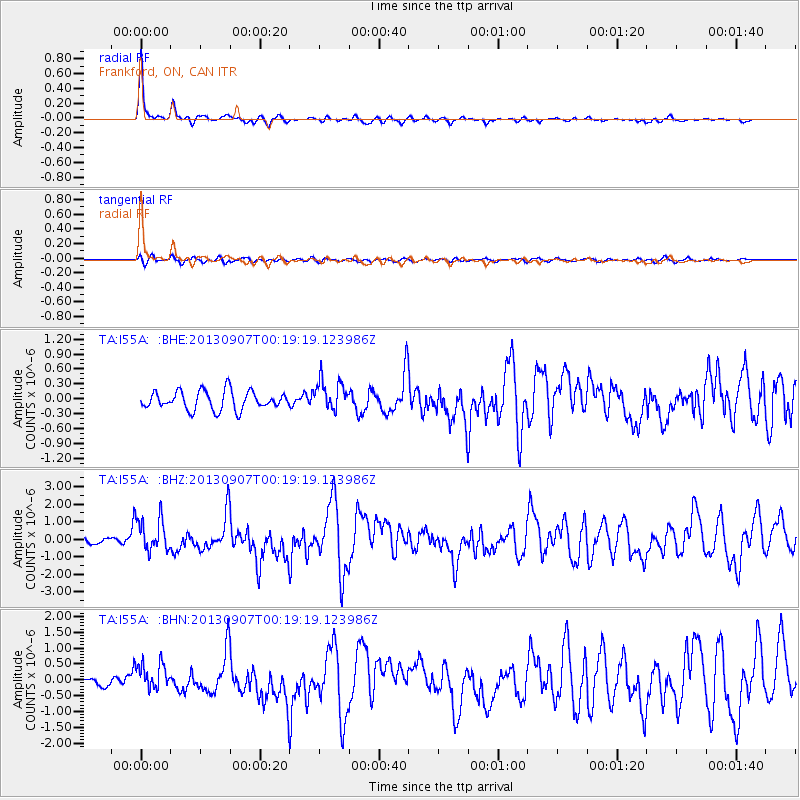
Earthquake location: Near Coast Of Chiapas, Mexico
Earthquake latitude/longitude: 14.6/-92.1
Earthquake time(UTC): 2013/09/07 (250) 00:13:29 GMT
Earthquake Depth: 66 km
Earthquake Magnitude: 6.4 MWW, 6.4 MWB, 6.4 MWC, 6.4 MWW, 6.5 MWC
Earthquake Catalog/Contributor: NEIC PDE/NEIC COMCAT
Network: TA USArray Transportable Network (new EarthScope stations)
Station: I55A Frankford, ON, CAN
Lat/Lon: 44.22 N/77.68 W
Elevation: 132 m
Distance: 32.0 deg
Az: 19.79 deg
Baz: 207.118 deg
Ray Param: 0.078694835
Estimated Moho Depth: 31.75 km
Estimated Crust Vp/Vs: 2.05
Assumed Crust Vp: 6.577 km/s
Estimated Crust Vs: 3.208 km/s
Estimated Crust Poisson's Ratio: 0.34
Radial Match: 91.18972 %
Radial Bump: 265
Transverse Match: 75.63819 %
Transverse Bump: 400
SOD ConfigId: 626651
Insert Time: 2014-04-18 15:07:38.427 +0000
GWidth: 2.5
Max Bumps: 400
Tol: 0.001

Signal To Noise

ChannelStoNSTALTA
TA:I55A: :BHZ:20130907T00:19:19.123986Z5.7147419.4956664E-71.6616092E-7
TA:I55A: :BHN:20130907T00:19:19.123986Z3.67772964.3966946E-71.1954916E-7
TA:I55A: :BHE:20130907T00:19:19.123986Z1.64449733.0749106E-71.869818E-7
Arrivals
Ps5.4 SECOND
PpPs14 SECOND
PsPs/PpSs19 SECOND