I58A Old Forge, NY, USA - Earthquake Result Viewer
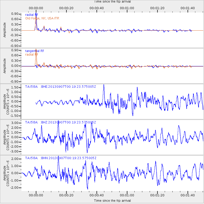
Earthquake location: Near Coast Of Chiapas, Mexico
Earthquake latitude/longitude: 14.6/-92.1
Earthquake time(UTC): 2013/09/07 (250) 00:13:29 GMT
Earthquake Depth: 66 km
Earthquake Magnitude: 6.4 MWW, 6.4 MWB, 6.4 MWC, 6.4 MWW, 6.5 MWC
Earthquake Catalog/Contributor: NEIC PDE/NEIC COMCAT
Network: TA USArray Transportable Network (new EarthScope stations)
Station: I58A Old Forge, NY, USA
Lat/Lon: 43.69 N/74.97 W
Elevation: 599 m
Distance: 32.5 deg
Az: 23.466 deg
Baz: 212.102 deg
Ray Param: 0.078478776
Estimated Moho Depth: 31.25 km
Estimated Crust Vp/Vs: 2.03
Assumed Crust Vp: 6.419 km/s
Estimated Crust Vs: 3.17 km/s
Estimated Crust Poisson's Ratio: 0.34
Radial Match: 89.00417 %
Radial Bump: 302
Transverse Match: 55.42714 %
Transverse Bump: 400
SOD ConfigId: 626651
Insert Time: 2014-04-18 15:07:43.531 +0000
GWidth: 2.5
Max Bumps: 400
Tol: 0.001

Signal To Noise

ChannelStoNSTALTA
TA:I58A: :BHZ:20130907T00:19:23.575005Z5.45018861.0357596E-61.9004105E-7
TA:I58A: :BHN:20130907T00:19:23.575005Z3.56704355.326705E-71.493311E-7
TA:I58A: :BHE:20130907T00:19:23.575005Z2.45092733.4798214E-71.419798E-7
Arrivals
Ps5.3 SECOND
PpPs14 SECOND
PsPs/PpSs19 SECOND