
J01E Myrtle Point, OR, USA - Earthquake Result Viewer
| ||||||||||||||||||
| ||||||||||||||||||
| ||||||||||||||||||
|
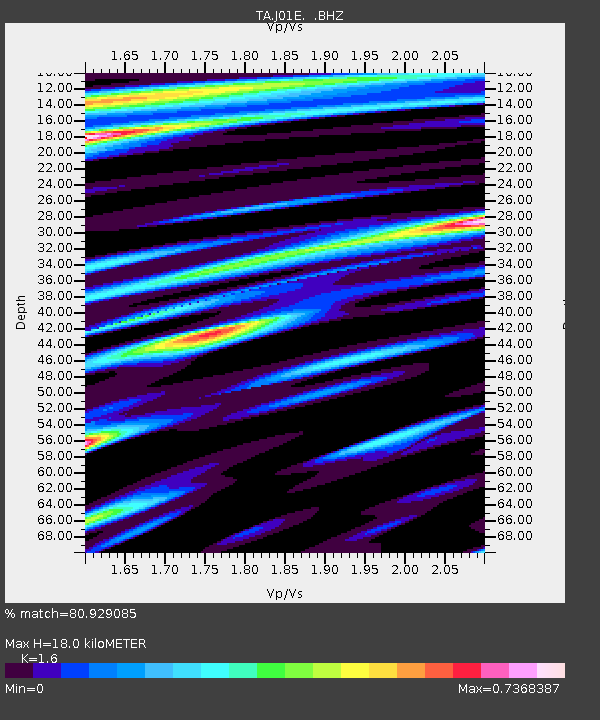
Signal To Noise
| Channel | StoN | STA | LTA |
| TA:J01E: :BHZ:20130907T00:20:22.498986Z | 2.3318884 | 8.787793E-7 | 3.7685305E-7 |
| TA:J01E: :BHN:20130907T00:20:22.498986Z | 1.1950227 | 2.884801E-7 | 2.4140135E-7 |
| TA:J01E: :BHE:20130907T00:20:22.498986Z | 0.8697787 | 3.0943968E-7 | 3.557683E-7 |
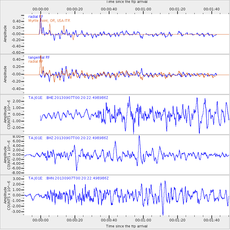
| Arrivals | |
| Ps | 1.8 SECOND |
| PpPs | 6.6 SECOND |
| PsPs/PpSs | 8.4 SECOND |

