
J54A Appleton, NY, USA - Earthquake Result Viewer
| ||||||||||||||||||
| ||||||||||||||||||
| ||||||||||||||||||
|
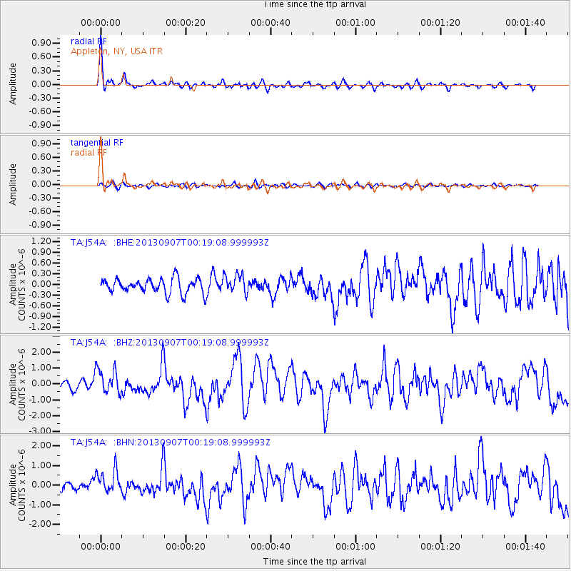
Signal To Noise
| Channel | StoN | STA | LTA |
| TA:J54A: :BHZ:20130907T00:19:08.999993Z | 2.211381 | 7.616801E-7 | 3.4443642E-7 |
| TA:J54A: :BHN:20130907T00:19:08.999993Z | 2.4200256 | 5.8699305E-7 | 2.4255655E-7 |
| TA:J54A: :BHE:20130907T00:19:08.999993Z | 1.2796359 | 2.604973E-7 | 2.0357143E-7 |
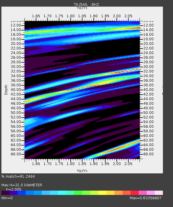
| Arrivals | |
| Ps | 5.6 SECOND |
| PpPs | 14 SECOND |
| PsPs/PpSs | 20 SECOND |

