J61A Chester, VT, USA - Earthquake Result Viewer
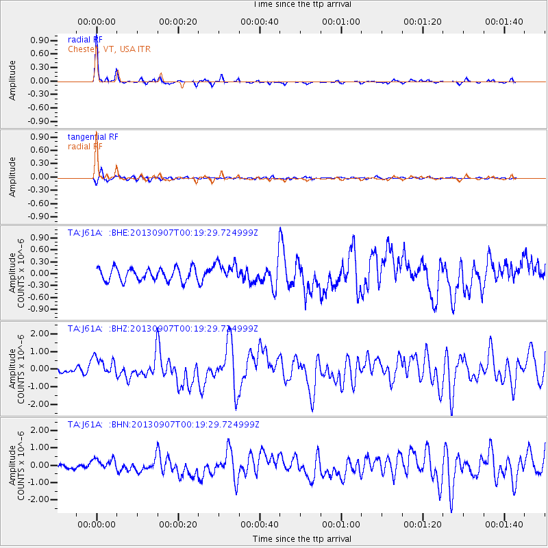
Earthquake location: Near Coast Of Chiapas, Mexico
Earthquake latitude/longitude: 14.6/-92.1
Earthquake time(UTC): 2013/09/07 (250) 00:13:29 GMT
Earthquake Depth: 66 km
Earthquake Magnitude: 6.4 MWW, 6.4 MWB, 6.4 MWC, 6.4 MWW, 6.5 MWC
Earthquake Catalog/Contributor: NEIC PDE/NEIC COMCAT
Network: TA USArray Transportable Network (new EarthScope stations)
Station: J61A Chester, VT, USA
Lat/Lon: 43.35 N/72.55 W
Elevation: 253 m
Distance: 33.2 deg
Az: 26.507 deg
Baz: 216.318 deg
Ray Param: 0.078156866
Estimated Moho Depth: 33.75 km
Estimated Crust Vp/Vs: 1.87
Assumed Crust Vp: 6.419 km/s
Estimated Crust Vs: 3.433 km/s
Estimated Crust Poisson's Ratio: 0.30
Radial Match: 92.260605 %
Radial Bump: 172
Transverse Match: 66.20441 %
Transverse Bump: 400
SOD ConfigId: 626651
Insert Time: 2014-04-18 15:08:16.900 +0000
GWidth: 2.5
Max Bumps: 400
Tol: 0.001

Signal To Noise

ChannelStoNSTALTA
TA:J61A: :BHZ:20130907T00:19:29.724999Z3.97709925.56055E-71.398142E-7
TA:J61A: :BHN:20130907T00:19:29.724999Z3.03933883.6645824E-71.205717E-7
TA:J61A: :BHE:20130907T00:19:29.724999Z1.51943992.4164774E-71.5903738E-7
Arrivals
Ps4.9 SECOND
PpPs14 SECOND
PsPs/PpSs19 SECOND