
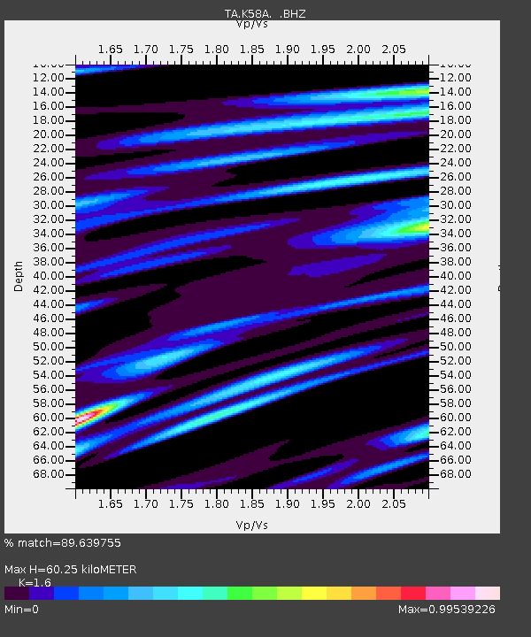
K58A Earlville, NY, USA - Earthquake Result Viewer
| ||||||||||||||||||
| ||||||||||||||||||
| ||||||||||||||||||
|
Signal To Noise
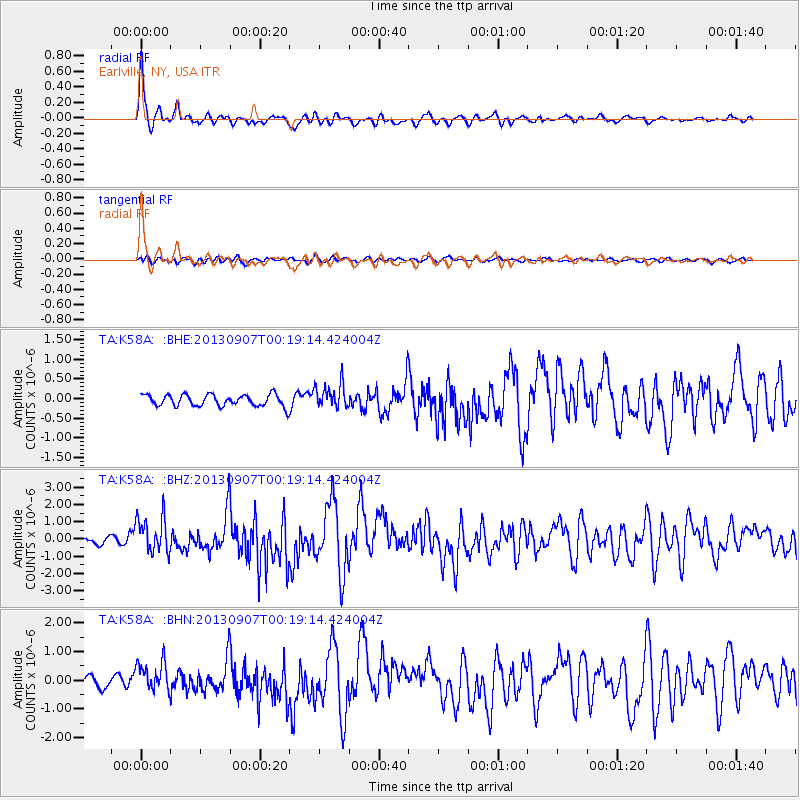
| Channel | StoN | STA | LTA |
| TA:K58A: :BHZ:20130907T00:19:14.424004Z | 5.6605353 | 1.0349455E-6 | 1.8283528E-7 |
| TA:K58A: :BHN:20130907T00:19:14.424004Z | 3.2007003 | 5.135868E-7 | 1.6046077E-7 |
| TA:K58A: :BHE:20130907T00:19:14.424004Z | 2.0848217 | 3.053276E-7 | 1.4645262E-7 |
| Arrivals | |
| Ps | 6.2 SECOND |
| PpPs | 22 SECOND |
| PsPs/PpSs | 28 SECOND |

