L04D Klamath Falls, OR, USA - Earthquake Result Viewer
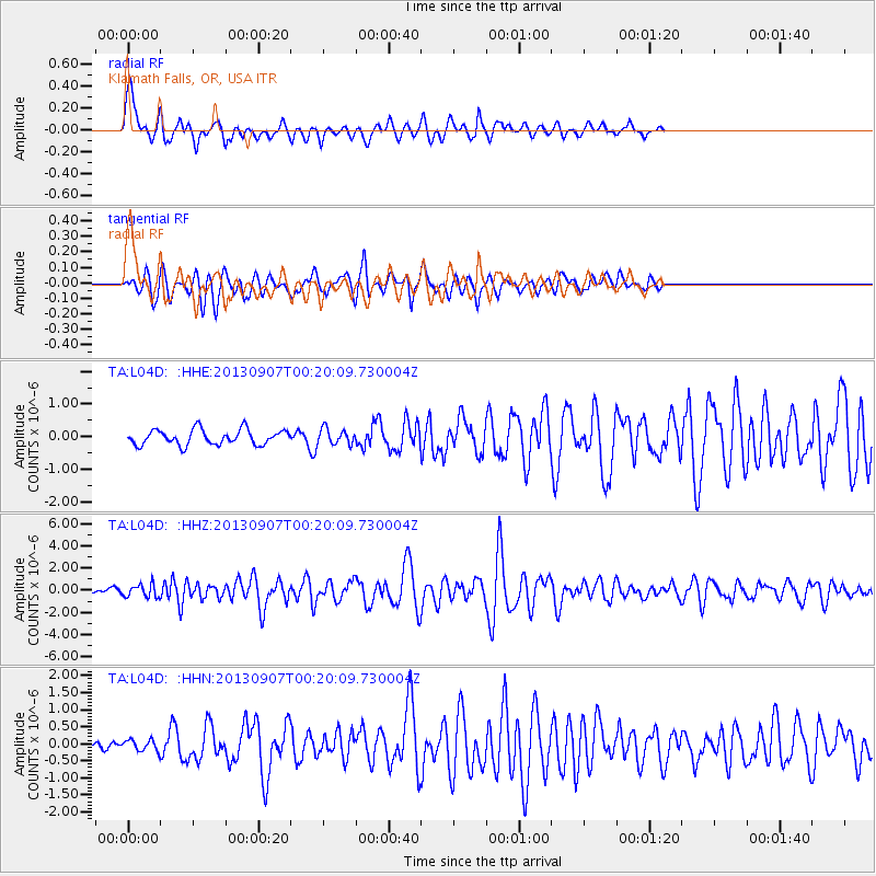
Earthquake location: Near Coast Of Chiapas, Mexico
Earthquake latitude/longitude: 14.6/-92.1
Earthquake time(UTC): 2013/09/07 (250) 00:13:29 GMT
Earthquake Depth: 66 km
Earthquake Magnitude: 6.4 MWW, 6.4 MWB, 6.4 MWC, 6.4 MWW, 6.5 MWC
Earthquake Catalog/Contributor: NEIC PDE/NEIC COMCAT
Network: TA USArray Transportable Network (new EarthScope stations)
Station: L04D Klamath Falls, OR, USA
Lat/Lon: 42.22 N/122.30 W
Elevation: 1437 m
Distance: 37.9 deg
Az: 322.527 deg
Baz: 127.545 deg
Ray Param: 0.075693
Estimated Moho Depth: 14.0 km
Estimated Crust Vp/Vs: 1.61
Assumed Crust Vp: 6.522 km/s
Estimated Crust Vs: 4.044 km/s
Estimated Crust Poisson's Ratio: 0.19
Radial Match: 83.14167 %
Radial Bump: 367
Transverse Match: 75.563995 %
Transverse Bump: 400
SOD ConfigId: 626651
Insert Time: 2014-04-18 15:08:46.813 +0000
GWidth: 2.5
Max Bumps: 400
Tol: 0.001

Signal To Noise

ChannelStoNSTALTA
TA:L04D: :HHZ:20130907T00:20:09.730004Z3.15318375.7845443E-71.8345091E-7
TA:L04D: :HHN:20130907T00:20:09.730004Z0.88765041.5759154E-71.7753786E-7
TA:L04D: :HHE:20130907T00:20:09.730004Z1.04699872.4109988E-72.3027715E-7
Arrivals
Ps1.4 SECOND
PpPs5.2 SECOND
PsPs/PpSs6.6 SECOND