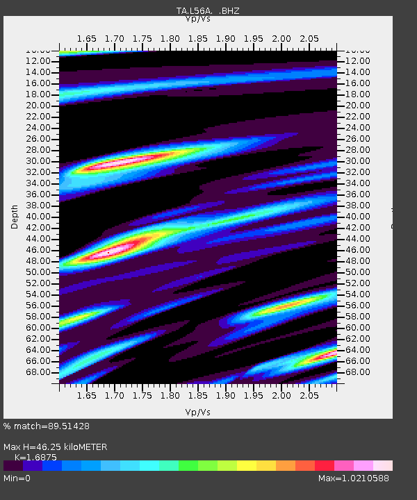
L56A Greenwood, NY, USA - Earthquake Result Viewer
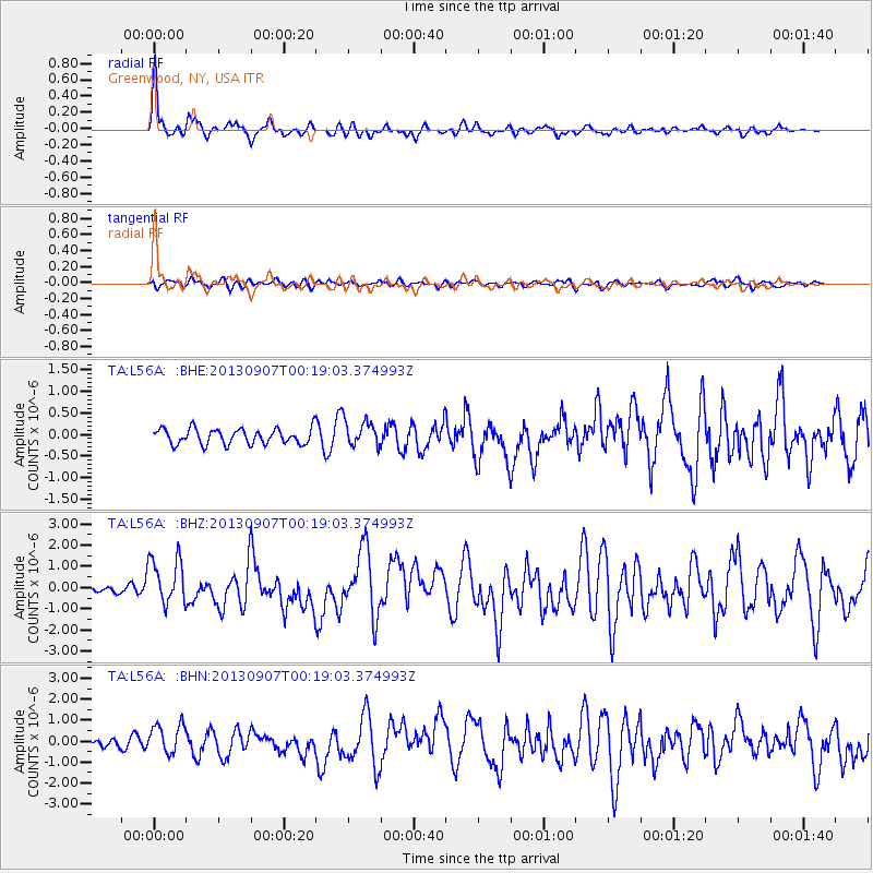
Earthquake location: Near Coast Of Chiapas, Mexico
Earthquake latitude/longitude: 14.6/-92.1
Earthquake time(UTC): 2013/09/07 (250) 00:13:29 GMT
Earthquake Depth: 66 km
Earthquake Magnitude: 6.4 MWW, 6.4 MWB, 6.4 MWC, 6.4 MWW, 6.5 MWC
Earthquake Catalog/Contributor: NEIC PDE/NEIC COMCAT
Network: TA USArray Transportable Network (new EarthScope stations)
Station: L56A Greenwood, NY, USA
Lat/Lon: 42.14 N/77.56 W
Elevation: 688 m
Distance: 30.2 deg
Az: 21.836 deg
Baz: 208.955 deg
Ray Param: 0.07930312
Estimated Moho Depth: 46.25 km
Estimated Crust Vp/Vs: 1.69
Assumed Crust Vp: 6.476 km/s
Estimated Crust Vs: 3.838 km/s
Estimated Crust Poisson's Ratio: 0.23
Radial Match: 89.51428 %
Radial Bump: 400
Transverse Match: 57.661766 %
Transverse Bump: 400
SOD ConfigId: 626651
Insert Time: 2014-04-18 15:08:51.102 +0000
GWidth: 2.5
Max Bumps: 400
Tol: 0.001

Signal To Noise

ChannelStoNSTALTA
TA:L56A: :BHZ:20130907T00:19:03.374993Z5.88929221.1222371E-61.9055553E-7
TA:L56A: :BHN:20130907T00:19:03.374993Z3.9954267.207058E-71.8038273E-7
TA:L56A: :BHE:20130907T00:19:03.374993Z1.70958193.0603562E-71.7901196E-7
Arrivals
Ps5.4 SECOND
PpPs18 SECOND
PsPs/PpSs23 SECOND