
L60A Shokan, NY, USA - Earthquake Result Viewer
| ||||||||||||||||||
| ||||||||||||||||||
| ||||||||||||||||||
|
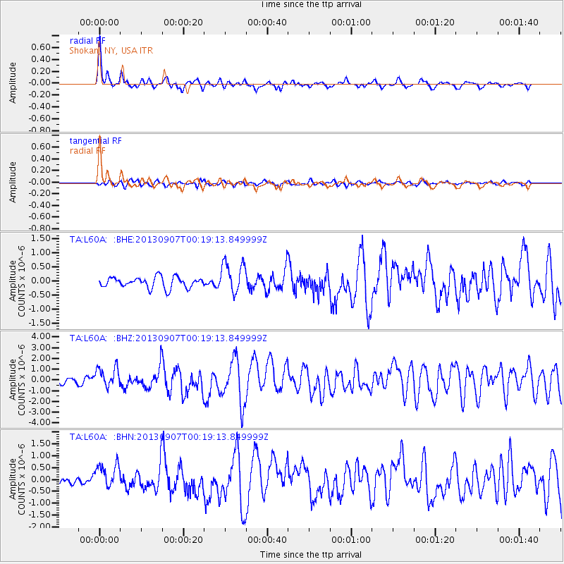
Signal To Noise
| Channel | StoN | STA | LTA |
| TA:L60A: :BHZ:20130907T00:19:13.849999Z | 3.8907156 | 9.4981834E-7 | 2.4412432E-7 |
| TA:L60A: :BHN:20130907T00:19:13.849999Z | 2.8156512 | 5.250553E-7 | 1.8647741E-7 |
| TA:L60A: :BHE:20130907T00:19:13.849999Z | 2.9562654 | 5.642584E-7 | 1.9086866E-7 |
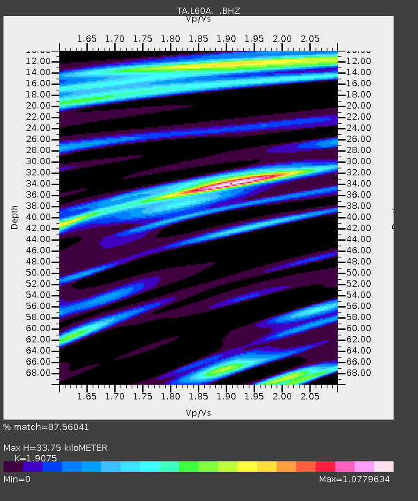
| Arrivals | |
| Ps | 5.2 SECOND |
| PpPs | 15 SECOND |
| PsPs/PpSs | 20 SECOND |

