
M61A Granite Springs, NY, USA - Earthquake Result Viewer
| ||||||||||||||||||
| ||||||||||||||||||
| ||||||||||||||||||
|
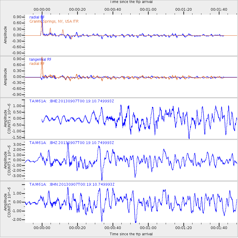
Signal To Noise
| Channel | StoN | STA | LTA |
| TA:M61A: :BHZ:20130907T00:19:10.749993Z | 5.4357247 | 9.2121473E-7 | 1.6947413E-7 |
| TA:M61A: :BHN:20130907T00:19:10.749993Z | 4.5099525 | 5.760719E-7 | 1.2773347E-7 |
| TA:M61A: :BHE:20130907T00:19:10.749993Z | 2.8378541 | 4.3079788E-7 | 1.518041E-7 |
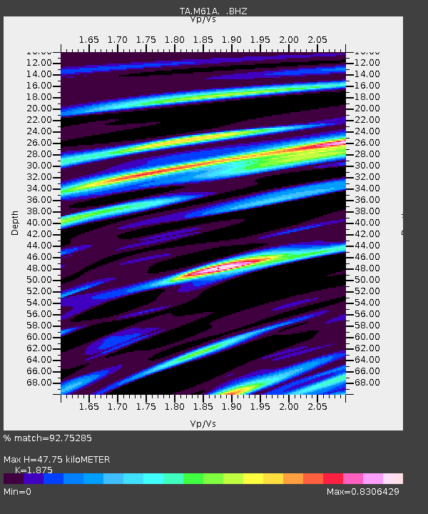
| Arrivals | |
| Ps | 7.0 SECOND |
| PpPs | 20 SECOND |
| PsPs/PpSs | 27 SECOND |

