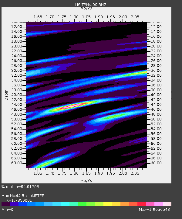
TPNV Topopah Spring, Nevada, USA - Earthquake Result Viewer
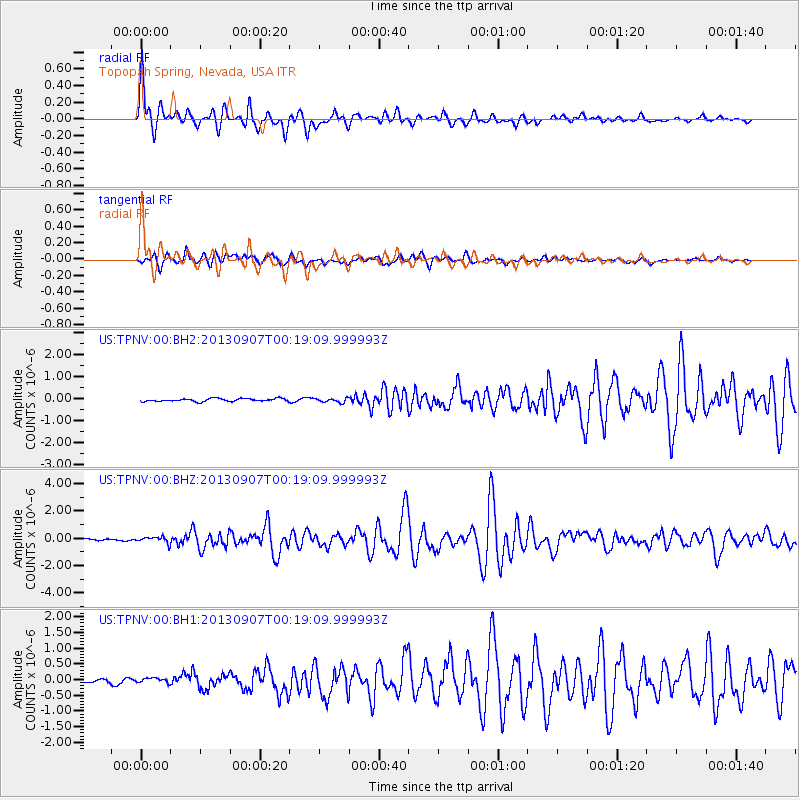
Earthquake location: Near Coast Of Chiapas, Mexico
Earthquake latitude/longitude: 14.6/-92.1
Earthquake time(UTC): 2013/09/07 (250) 00:13:29 GMT
Earthquake Depth: 66 km
Earthquake Magnitude: 6.4 MWW, 6.4 MWB, 6.4 MWC, 6.4 MWW, 6.5 MWC
Earthquake Catalog/Contributor: NEIC PDE/NEIC COMCAT
Network: US United States National Seismic Network
Station: TPNV Topopah Spring, Nevada, USA
Lat/Lon: 36.95 N/116.25 W
Elevation: 1600 m
Distance: 30.9 deg
Az: 320.426 deg
Baz: 129.657 deg
Ray Param: 0.0791065
Estimated Moho Depth: 44.5 km
Estimated Crust Vp/Vs: 1.79
Assumed Crust Vp: 6.279 km/s
Estimated Crust Vs: 3.517 km/s
Estimated Crust Poisson's Ratio: 0.27
Radial Match: 94.91798 %
Radial Bump: 380
Transverse Match: 82.97411 %
Transverse Bump: 400
SOD ConfigId: 626651
Insert Time: 2014-04-18 15:11:25.942 +0000
GWidth: 2.5
Max Bumps: 400
Tol: 0.001

Signal To Noise

ChannelStoNSTALTA
US:TPNV:00:BHZ:20130907T00:19:09.999993Z3.18676972.2528504E-77.069385E-8
US:TPNV:00:BH1:20130907T00:19:09.999993Z1.13210929.713284E-88.579812E-8
US:TPNV:00:BH2:20130907T00:19:09.999993Z1.47218089.511341E-86.460715E-8
Arrivals
Ps6.0 SECOND
PpPs18 SECOND
PsPs/PpSs24 SECOND