
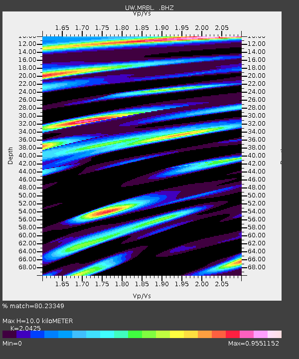
MRBL Marblemount, WA, USA - Earthquake Result Viewer
| ||||||||||||||||||
| ||||||||||||||||||
| ||||||||||||||||||
|
Signal To Noise
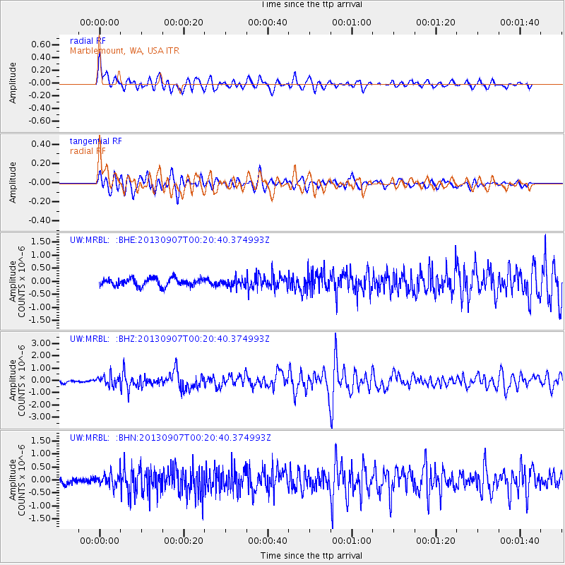
| Channel | StoN | STA | LTA |
| UW:MRBL: :BHZ:20130907T00:20:40.374993Z | 3.134373 | 4.0701497E-7 | 1.2985531E-7 |
| UW:MRBL: :BHN:20130907T00:20:40.374993Z | 1.9705089 | 2.3956267E-7 | 1.21574E-7 |
| UW:MRBL: :BHE:20130907T00:20:40.374993Z | 1.0465696 | 1.5563155E-7 | 1.4870635E-7 |
| Arrivals | |
| Ps | 1.7 SECOND |
| PpPs | 4.4 SECOND |
| PsPs/PpSs | 6.0 SECOND |

