You are here: Home > Network List > G - GEOSCOPE Stations List
> Station INU Inuyama, Japan > Earthquake Result Viewer
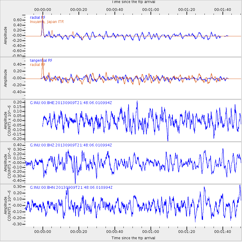
INU Inuyama, Japan - Earthquake Result Viewer
*The percent match for this event was below the threshold and hence no stack was calculated.
| Earthquake location: |
Minahassa Peninsula, Sulawesi |
| Earthquake latitude/longitude: |
1.4/122.2 |
| Earthquake time(UTC): |
2013/09/09 (252) 21:41:33 GMT |
| Earthquake Depth: |
22 km |
| Earthquake Magnitude: |
5.6 MWW, 5.4 MWB, 5.6 MWW, 5.6 MWC |
| Earthquake Catalog/Contributor: |
NEIC PDE/NEIC COMCAT |
|
| Network: |
G GEOSCOPE |
| Station: |
INU Inuyama, Japan |
| Lat/Lon: |
35.35 N/137.03 E |
| Elevation: |
132 m |
|
| Distance: |
36.5 deg |
| Az: |
20.561 deg |
| Baz: |
205.436 deg |
| Ray Param: |
$rayparam |
*The percent match for this event was below the threshold and hence was not used in the summary stack. |
|
| Radial Match: |
65.48609 % |
| Radial Bump: |
400 |
| Transverse Match: |
48.772636 % |
| Transverse Bump: |
400 |
| SOD ConfigId: |
626651 |
| Insert Time: |
2014-04-18 15:18:30.519 +0000 |
| GWidth: |
2.5 |
| Max Bumps: |
400 |
| Tol: |
0.001 |
|
Signal To Noise
| Channel | StoN | STA | LTA |
| G:INU:00:BHZ:20130909T21:48:06.010994Z | 2.5575268 | 1.4105979E-7 | 5.515476E-8 |
| G:INU:00:BHN:20130909T21:48:06.010994Z | 1.1966655 | 6.6371456E-8 | 5.5463662E-8 |
| G:INU:00:BHE:20130909T21:48:06.010994Z | 1.1644058 | 5.5821044E-8 | 4.7939512E-8 |
| Arrivals |
| Ps | |
| PpPs | |
| PsPs/PpSs | |


