You are here: Home > Network List > IU - Global Seismograph Network (GSN - IRIS/USGS) Stations List
> Station HNR Honiara, Solomon Islands > Earthquake Result Viewer
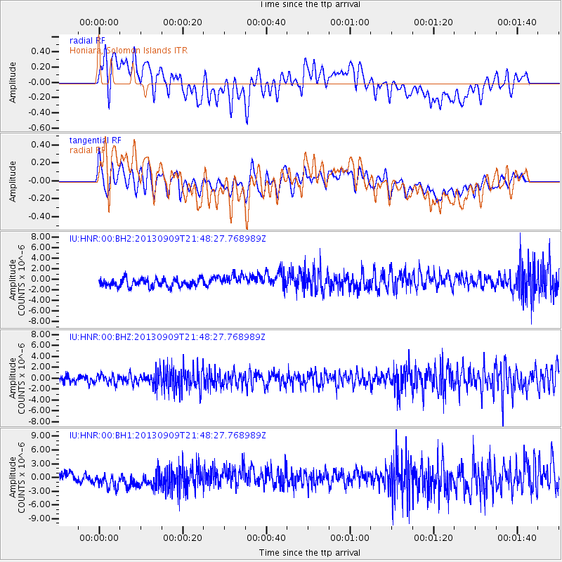
HNR Honiara, Solomon Islands - Earthquake Result Viewer
*The percent match for this event was below the threshold and hence no stack was calculated.
| Earthquake location: |
Minahassa Peninsula, Sulawesi |
| Earthquake latitude/longitude: |
1.4/122.2 |
| Earthquake time(UTC): |
2013/09/09 (252) 21:41:33 GMT |
| Earthquake Depth: |
22 km |
| Earthquake Magnitude: |
5.6 MWW, 5.4 MWB, 5.6 MWW, 5.6 MWC |
| Earthquake Catalog/Contributor: |
NEIC PDE/NEIC COMCAT |
|
| Network: |
IU Global Seismograph Network (GSN - IRIS/USGS) |
| Station: |
HNR Honiara, Solomon Islands |
| Lat/Lon: |
9.44 S/159.95 E |
| Elevation: |
100 m |
|
| Distance: |
39.1 deg |
| Az: |
106.739 deg |
| Baz: |
283.995 deg |
| Ray Param: |
$rayparam |
*The percent match for this event was below the threshold and hence was not used in the summary stack. |
|
| Radial Match: |
47.331284 % |
| Radial Bump: |
400 |
| Transverse Match: |
54.316532 % |
| Transverse Bump: |
400 |
| SOD ConfigId: |
626651 |
| Insert Time: |
2014-04-18 15:21:11.035 +0000 |
| GWidth: |
2.5 |
| Max Bumps: |
400 |
| Tol: |
0.001 |
|
Signal To Noise
| Channel | StoN | STA | LTA |
| IU:HNR:00:BHZ:20130909T21:48:27.768989Z | 1.4658167 | 8.137227E-7 | 5.551326E-7 |
| IU:HNR:00:BH1:20130909T21:48:27.768989Z | 2.324561 | 2.1482406E-6 | 9.241489E-7 |
| IU:HNR:00:BH2:20130909T21:48:27.768989Z | 1.5325521 | 1.1669202E-6 | 7.614229E-7 |
| Arrivals |
| Ps | |
| PpPs | |
| PsPs/PpSs | |


