You are here: Home > Network List > IU - Global Seismograph Network (GSN - IRIS/USGS) Stations List
> Station MAJO Matsushiro, Japan > Earthquake Result Viewer
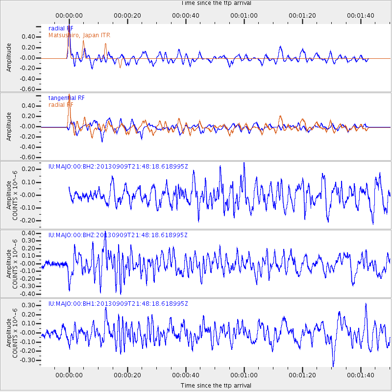
MAJO Matsushiro, Japan - Earthquake Result Viewer
*The percent match for this event was below the threshold and hence no stack was calculated.
| Earthquake location: |
Minahassa Peninsula, Sulawesi |
| Earthquake latitude/longitude: |
1.4/122.2 |
| Earthquake time(UTC): |
2013/09/09 (252) 21:41:33 GMT |
| Earthquake Depth: |
22 km |
| Earthquake Magnitude: |
5.6 MWW, 5.4 MWB, 5.6 MWW, 5.6 MWC |
| Earthquake Catalog/Contributor: |
NEIC PDE/NEIC COMCAT |
|
| Network: |
IU Global Seismograph Network (GSN - IRIS/USGS) |
| Station: |
MAJO Matsushiro, Japan |
| Lat/Lon: |
36.55 N/138.20 E |
| Elevation: |
405 m |
|
| Distance: |
38.0 deg |
| Az: |
21.113 deg |
| Baz: |
206.563 deg |
| Ray Param: |
$rayparam |
*The percent match for this event was below the threshold and hence was not used in the summary stack. |
|
| Radial Match: |
65.37675 % |
| Radial Bump: |
400 |
| Transverse Match: |
54.721592 % |
| Transverse Bump: |
400 |
| SOD ConfigId: |
626651 |
| Insert Time: |
2014-04-18 15:21:19.963 +0000 |
| GWidth: |
2.5 |
| Max Bumps: |
400 |
| Tol: |
0.001 |
|
Signal To Noise
| Channel | StoN | STA | LTA |
| IU:MAJO:00:BHZ:20130909T21:48:18.618995Z | 4.0244207 | 1.486882E-7 | 3.6946485E-8 |
| IU:MAJO:00:BH1:20130909T21:48:18.618995Z | 1.4263004 | 6.90285E-8 | 4.839689E-8 |
| IU:MAJO:00:BH2:20130909T21:48:18.618995Z | 1.4335915 | 6.824877E-8 | 4.7606843E-8 |
| Arrivals |
| Ps | |
| PpPs | |
| PsPs/PpSs | |


