You are here: Home > Network List > TA - USArray Transportable Network (new EarthScope stations) Stations List
> Station M53A WI Miller and Sons, Farmdale, OH, USA > Earthquake Result Viewer
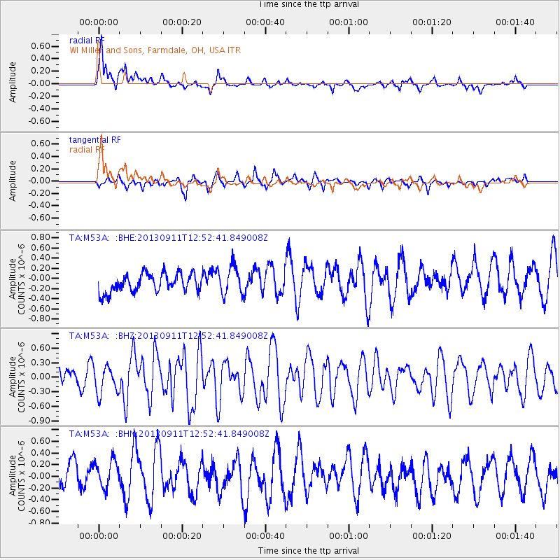
M53A WI Miller and Sons, Farmdale, OH, USA - Earthquake Result Viewer
*The percent match for this event was below the threshold and hence no stack was calculated.
| Earthquake location: |
Central East Pacific Rise |
| Earthquake latitude/longitude: |
-4.5/-104.6 |
| Earthquake time(UTC): |
2013/09/11 (254) 12:44:13 GMT |
| Earthquake Depth: |
10 km |
| Earthquake Magnitude: |
6.1 MWW, 6.0 MWB, 6.1 MWW, 6.1 MWC |
| Earthquake Catalog/Contributor: |
NEIC PDE/NEIC COMCAT |
|
| Network: |
TA USArray Transportable Network (new EarthScope stations) |
| Station: |
M53A WI Miller and Sons, Farmdale, OH, USA |
| Lat/Lon: |
41.44 N/80.68 W |
| Elevation: |
334 m |
|
| Distance: |
50.7 deg |
| Az: |
23.182 deg |
| Baz: |
211.463 deg |
| Ray Param: |
$rayparam |
*The percent match for this event was below the threshold and hence was not used in the summary stack. |
|
| Radial Match: |
76.53839 % |
| Radial Bump: |
400 |
| Transverse Match: |
69.55456 % |
| Transverse Bump: |
400 |
| SOD ConfigId: |
626651 |
| Insert Time: |
2014-04-18 15:47:34.057 +0000 |
| GWidth: |
2.5 |
| Max Bumps: |
400 |
| Tol: |
0.001 |
|
Signal To Noise
| Channel | StoN | STA | LTA |
| TA:M53A: :BHZ:20130911T12:52:41.849008Z | 1.4297074 | 2.8330055E-7 | 1.9815282E-7 |
| TA:M53A: :BHN:20130911T12:52:41.849008Z | 0.9584041 | 2.879114E-7 | 3.0040712E-7 |
| TA:M53A: :BHE:20130911T12:52:41.849008Z | 1.5912973 | 2.8756855E-7 | 1.8071329E-7 |
| Arrivals |
| Ps | |
| PpPs | |
| PsPs/PpSs | |


