You are here: Home > Network List > TA - USArray Transportable Network (new EarthScope stations) Stations List
> Station O03E Paynes Creek, CA, USA > Earthquake Result Viewer
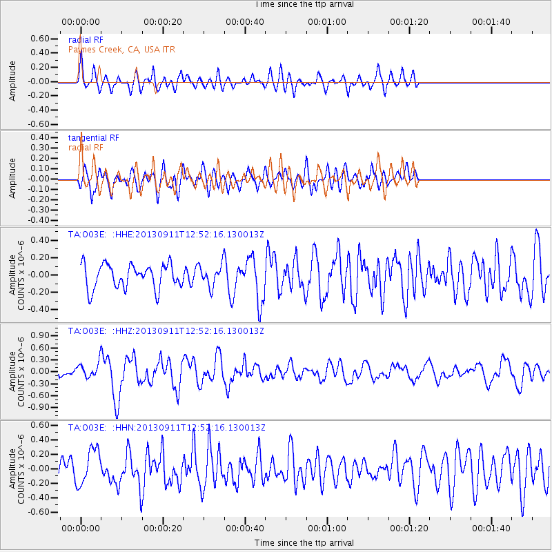
O03E Paynes Creek, CA, USA - Earthquake Result Viewer
*The percent match for this event was below the threshold and hence no stack was calculated.
| Earthquake location: |
Central East Pacific Rise |
| Earthquake latitude/longitude: |
-4.5/-104.6 |
| Earthquake time(UTC): |
2013/09/11 (254) 12:44:13 GMT |
| Earthquake Depth: |
10 km |
| Earthquake Magnitude: |
6.1 MWW, 6.0 MWB, 6.1 MWW, 6.1 MWC |
| Earthquake Catalog/Contributor: |
NEIC PDE/NEIC COMCAT |
|
| Network: |
TA USArray Transportable Network (new EarthScope stations) |
| Station: |
O03E Paynes Creek, CA, USA |
| Lat/Lon: |
40.29 N/121.80 W |
| Elevation: |
967 m |
|
| Distance: |
47.3 deg |
| Az: |
342.065 deg |
| Baz: |
156.337 deg |
| Ray Param: |
$rayparam |
*The percent match for this event was below the threshold and hence was not used in the summary stack. |
|
| Radial Match: |
68.6854 % |
| Radial Bump: |
400 |
| Transverse Match: |
51.58698 % |
| Transverse Bump: |
400 |
| SOD ConfigId: |
626651 |
| Insert Time: |
2014-04-18 15:48:23.726 +0000 |
| GWidth: |
2.5 |
| Max Bumps: |
400 |
| Tol: |
0.001 |
|
Signal To Noise
| Channel | StoN | STA | LTA |
| TA:O03E: :HHZ:20130911T12:52:16.130013Z | 1.1036853 | 1.8633853E-7 | 1.6883303E-7 |
| TA:O03E: :HHN:20130911T12:52:16.130013Z | 2.2246196 | 2.5448705E-7 | 1.1439575E-7 |
| TA:O03E: :HHE:20130911T12:52:16.130013Z | 0.8826439 | 1.2207144E-7 | 1.3830203E-7 |
| Arrivals |
| Ps | |
| PpPs | |
| PsPs/PpSs | |


