HEH Heihe,Heilongjiang Province - Earthquake Result Viewer
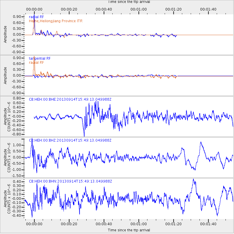
Earthquake location: Andreanof Islands, Aleutian Is.
Earthquake latitude/longitude: 51.4/-174.6
Earthquake time(UTC): 2013/09/14 (257) 15:42:46 GMT
Earthquake Depth: 20 km
Earthquake Magnitude: 5.9 MWW, 5.4 MI, 5.8 MWB, 5.9 MWC, 6.0 MWC
Earthquake Catalog/Contributor: NEIC PDE/NEIC COMCAT
Network: CB China National Seismic Network
Station: HEH Heihe,Heilongjiang Province
Lat/Lon: 50.25 N/127.41 E
Elevation: 165 m
Distance: 35.8 deg
Az: 291.495 deg
Baz: 65.124 deg
Ray Param: 0.07701016
Estimated Moho Depth: 45.5 km
Estimated Crust Vp/Vs: 2.02
Assumed Crust Vp: 6.419 km/s
Estimated Crust Vs: 3.174 km/s
Estimated Crust Poisson's Ratio: 0.34
Radial Match: 92.522 %
Radial Bump: 322
Transverse Match: 48.231445 %
Transverse Bump: 400
SOD ConfigId: 626651
Insert Time: 2014-04-18 16:00:31.722 +0000
GWidth: 2.5
Max Bumps: 400
Tol: 0.001

Signal To Noise

ChannelStoNSTALTA
CB:HEH:00:BHZ:20130914T15:49:13.049988Z8.4133625.4258385E-76.4490735E-8
CB:HEH:00:BHN:20130914T15:49:13.049988Z1.90506861.8780514E-79.858183E-8
CB:HEH:00:BHE:20130914T15:49:13.049988Z5.2541813.189109E-76.06966E-8
Arrivals
Ps7.7 SECOND
PpPs20 SECOND
PsPs/PpSs28 SECOND