You are here: Home > Network List > CI - Caltech Regional Seismic Network Stations List
> Station TIN Tinemaha, California, USA > Earthquake Result Viewer
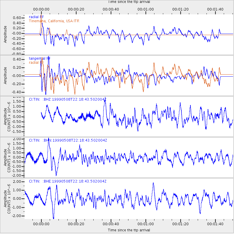
TIN Tinemaha, California, USA - Earthquake Result Viewer
*The percent match for this event was below the threshold and hence no stack was calculated.
| Earthquake location: |
Guatemala |
| Earthquake latitude/longitude: |
14.2/-91.9 |
| Earthquake time(UTC): |
1999/05/08 (128) 22:12:45 GMT |
| Earthquake Depth: |
39 km |
| Earthquake Magnitude: |
5.3 MB, 5.7 MS, 6.3 MW, 5.4 MD |
| Earthquake Catalog/Contributor: |
WHDF/NEIC |
|
| Network: |
CI Caltech Regional Seismic Network |
| Station: |
TIN Tinemaha, California, USA |
| Lat/Lon: |
37.05 N/118.23 W |
| Elevation: |
1164 m |
|
| Distance: |
32.6 deg |
| Az: |
318.951 deg |
| Baz: |
127.244 deg |
| Ray Param: |
$rayparam |
*The percent match for this event was below the threshold and hence was not used in the summary stack. |
|
| Radial Match: |
64.72486 % |
| Radial Bump: |
400 |
| Transverse Match: |
64.45873 % |
| Transverse Bump: |
400 |
| SOD ConfigId: |
4480 |
| Insert Time: |
2010-02-25 20:52:08.740 +0000 |
| GWidth: |
2.5 |
| Max Bumps: |
400 |
| Tol: |
0.001 |
|
Signal To Noise
| Channel | StoN | STA | LTA |
| CI:TIN: :BHN:19990508T22:18:43.502004Z | 2.4358435 | 8.0273935E-7 | 3.2955293E-7 |
| CI:TIN: :BHE:19990508T22:18:43.502004Z | 1.3838782 | 7.2983215E-7 | 5.2738176E-7 |
| CI:TIN: :BHZ:19990508T22:18:43.502004Z | 0.9499868 | 3.898273E-7 | 4.1035025E-7 |
| Arrivals |
| Ps | |
| PpPs | |
| PsPs/PpSs | |


