Q51A Peebles, OH, USA - Earthquake Result Viewer
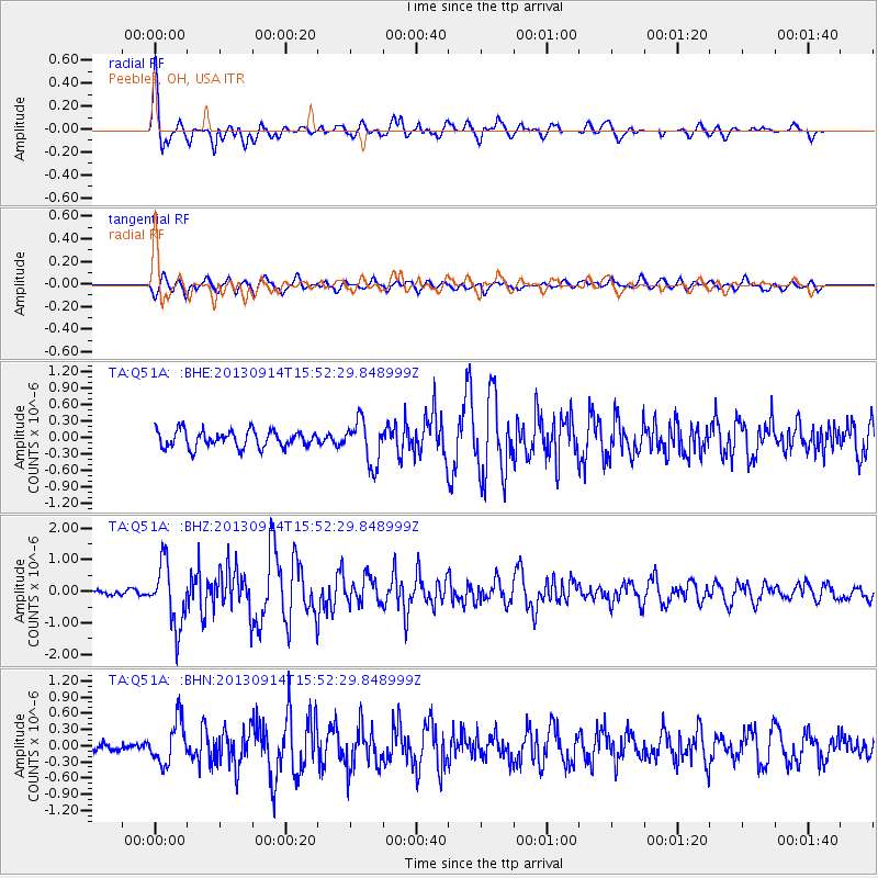
Earthquake location: Andreanof Islands, Aleutian Is.
Earthquake latitude/longitude: 51.4/-174.6
Earthquake time(UTC): 2013/09/14 (257) 15:42:46 GMT
Earthquake Depth: 20 km
Earthquake Magnitude: 5.9 MWW, 5.4 MI, 5.8 MWB, 5.9 MWC, 6.0 MWC
Earthquake Catalog/Contributor: NEIC PDE/NEIC COMCAT
Network: TA USArray Transportable Network (new EarthScope stations)
Station: Q51A Peebles, OH, USA
Lat/Lon: 39.03 N/83.35 W
Elevation: 362 m
Distance: 61.4 deg
Az: 62.452 deg
Baz: 314.565 deg
Ray Param: 0.060851302
Estimated Moho Depth: 26.25 km
Estimated Crust Vp/Vs: 1.86
Assumed Crust Vp: 6.232 km/s
Estimated Crust Vs: 3.35 km/s
Estimated Crust Poisson's Ratio: 0.30
Radial Match: 88.64598 %
Radial Bump: 400
Transverse Match: 76.12517 %
Transverse Bump: 400
SOD ConfigId: 626651
Insert Time: 2014-04-18 16:36:21.727 +0000
GWidth: 2.5
Max Bumps: 400
Tol: 0.001

Signal To Noise

ChannelStoNSTALTA
TA:Q51A: :BHZ:20130914T15:52:29.848999Z9.2536789.777776E-71.0566367E-7
TA:Q51A: :BHN:20130914T15:52:29.848999Z4.8345873.98183E-78.236133E-8
TA:Q51A: :BHE:20130914T15:52:29.848999Z2.5801283.9075897E-71.5144946E-7
Arrivals
Ps3.8 SECOND
PpPs12 SECOND
PsPs/PpSs15 SECOND