
V48A Smith Brothers Farm, Spring Hill, TN, USA - Earthquake Result Viewer
| ||||||||||||||||||
| ||||||||||||||||||
| ||||||||||||||||||
|
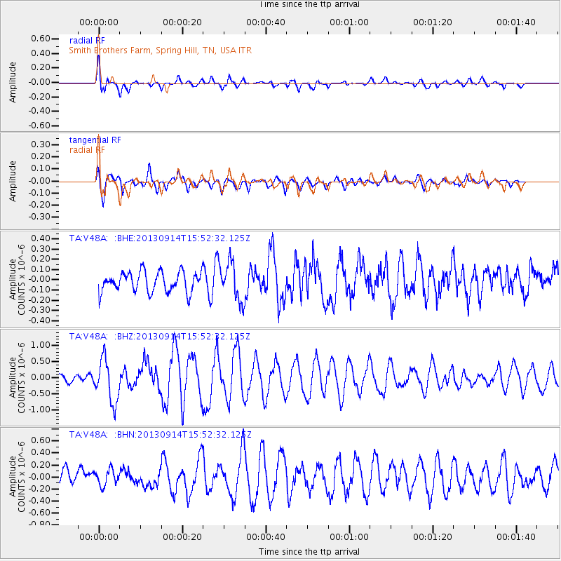
Signal To Noise
| Channel | StoN | STA | LTA |
| TA:V48A: :BHZ:20130914T15:52:32.125Z | 3.7338915 | 6.778766E-7 | 1.8154694E-7 |
| TA:V48A: :BHN:20130914T15:52:32.125Z | 0.81579065 | 1.2990986E-7 | 1.5924412E-7 |
| TA:V48A: :BHE:20130914T15:52:32.125Z | 1.8879373 | 1.854037E-7 | 9.8204374E-8 |
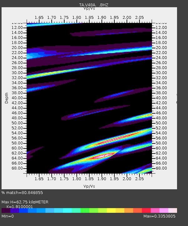
| Arrivals | |
| Ps | 9.2 SECOND |
| PpPs | 27 SECOND |
| PsPs/PpSs | 36 SECOND |

