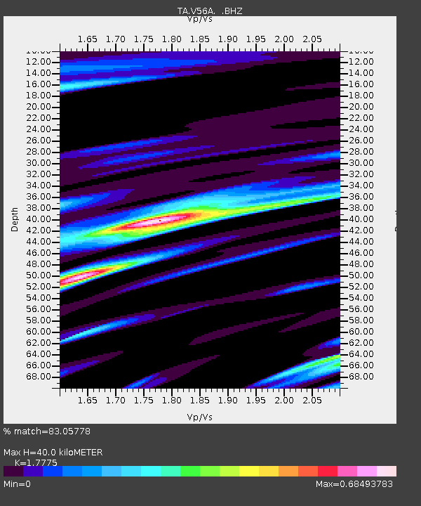
V56A Mocksville, NC, USA - Earthquake Result Viewer
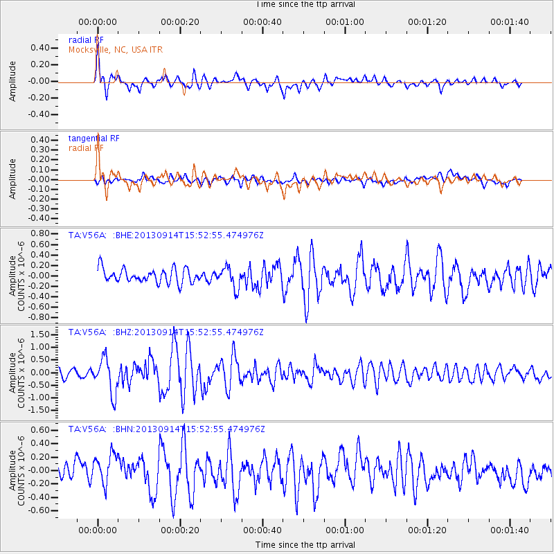
Earthquake location: Andreanof Islands, Aleutian Is.
Earthquake latitude/longitude: 51.4/-174.6
Earthquake time(UTC): 2013/09/14 (257) 15:42:46 GMT
Earthquake Depth: 20 km
Earthquake Magnitude: 5.9 MWW, 5.4 MI, 5.8 MWB, 5.9 MWC, 6.0 MWC
Earthquake Catalog/Contributor: NEIC PDE/NEIC COMCAT
Network: TA USArray Transportable Network (new EarthScope stations)
Station: V56A Mocksville, NC, USA
Lat/Lon: 35.81 N/80.50 W
Elevation: 237 m
Distance: 65.3 deg
Az: 63.152 deg
Baz: 316.604 deg
Ray Param: 0.058328763
Estimated Moho Depth: 40.0 km
Estimated Crust Vp/Vs: 1.78
Assumed Crust Vp: 6.419 km/s
Estimated Crust Vs: 3.611 km/s
Estimated Crust Poisson's Ratio: 0.27
Radial Match: 83.05778 %
Radial Bump: 400
Transverse Match: 59.46597 %
Transverse Bump: 400
SOD ConfigId: 626651
Insert Time: 2014-04-18 16:40:31.959 +0000
GWidth: 2.5
Max Bumps: 400
Tol: 0.001

Signal To Noise

ChannelStoNSTALTA
TA:V56A: :BHZ:20130914T15:52:55.474976Z3.50385647.1904043E-72.0521401E-7
TA:V56A: :BHN:20130914T15:52:55.474976Z2.02454782.4300493E-71.2002924E-7
TA:V56A: :BHE:20130914T15:52:55.474976Z1.52157842.0137105E-71.3234353E-7
Arrivals
Ps5.0 SECOND
PpPs17 SECOND
PsPs/PpSs22 SECOND