You are here: Home > Network List > TA - USArray Transportable Network (new EarthScope stations) Stations List
> Station V62A Hyde County Airport, Englehard, NC, USA > Earthquake Result Viewer
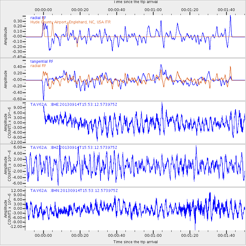
V62A Hyde County Airport, Englehard, NC, USA - Earthquake Result Viewer
*The percent match for this event was below the threshold and hence no stack was calculated.
| Earthquake location: |
Andreanof Islands, Aleutian Is. |
| Earthquake latitude/longitude: |
51.4/-174.6 |
| Earthquake time(UTC): |
2013/09/14 (257) 15:42:46 GMT |
| Earthquake Depth: |
20 km |
| Earthquake Magnitude: |
5.9 MWW, 5.4 MI, 5.8 MWB, 5.9 MWC, 6.0 MWC |
| Earthquake Catalog/Contributor: |
NEIC PDE/NEIC COMCAT |
|
| Network: |
TA USArray Transportable Network (new EarthScope stations) |
| Station: |
V62A Hyde County Airport, Englehard, NC, USA |
| Lat/Lon: |
35.56 N/75.96 W |
| Elevation: |
-3.0 m |
|
| Distance: |
68.0 deg |
| Az: |
60.374 deg |
| Baz: |
318.14 deg |
| Ray Param: |
$rayparam |
*The percent match for this event was below the threshold and hence was not used in the summary stack. |
|
| Radial Match: |
57.602173 % |
| Radial Bump: |
400 |
| Transverse Match: |
35.82101 % |
| Transverse Bump: |
400 |
| SOD ConfigId: |
626651 |
| Insert Time: |
2014-04-18 16:40:57.343 +0000 |
| GWidth: |
2.5 |
| Max Bumps: |
400 |
| Tol: |
0.001 |
|
Signal To Noise
| Channel | StoN | STA | LTA |
| TA:V62A: :BHZ:20130914T15:53:12.573975Z | 0.82455146 | 2.368686E-6 | 2.8726965E-6 |
| TA:V62A: :BHN:20130914T15:53:12.573975Z | 1.4594692 | 4.9508253E-6 | 3.3922092E-6 |
| TA:V62A: :BHE:20130914T15:53:12.573975Z | 2.0887764 | 5.2567375E-6 | 2.516659E-6 |
| Arrivals |
| Ps | |
| PpPs | |
| PsPs/PpSs | |


