RLMT Red Lodge, Montana, USA - Earthquake Result Viewer
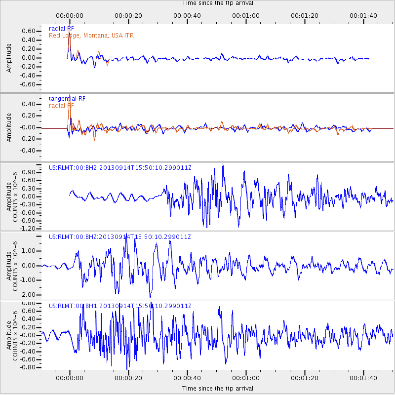
Earthquake location: Andreanof Islands, Aleutian Is.
Earthquake latitude/longitude: 51.4/-174.6
Earthquake time(UTC): 2013/09/14 (257) 15:42:46 GMT
Earthquake Depth: 20 km
Earthquake Magnitude: 5.9 MWW, 5.4 MI, 5.8 MWB, 5.9 MWC, 6.0 MWC
Earthquake Catalog/Contributor: NEIC PDE/NEIC COMCAT
Network: US United States National Seismic Network
Station: RLMT Red Lodge, Montana, USA
Lat/Lon: 45.12 N/109.27 W
Elevation: 2086 m
Distance: 42.7 deg
Az: 71.773 deg
Baz: 302.889 deg
Ray Param: 0.07302358
Estimated Moho Depth: 22.5 km
Estimated Crust Vp/Vs: 1.84
Assumed Crust Vp: 6.242 km/s
Estimated Crust Vs: 3.402 km/s
Estimated Crust Poisson's Ratio: 0.29
Radial Match: 89.20769 %
Radial Bump: 400
Transverse Match: 61.690666 %
Transverse Bump: 400
SOD ConfigId: 626651
Insert Time: 2014-04-18 16:46:15.561 +0000
GWidth: 2.5
Max Bumps: 400
Tol: 0.001

Signal To Noise

ChannelStoNSTALTA
US:RLMT:00:BHZ:20130914T15:50:10.299011Z3.50522925.874625E-71.6759603E-7
US:RLMT:00:BH1:20130914T15:50:10.299011Z3.74245293.1636287E-78.453356E-8
US:RLMT:00:BH2:20130914T15:50:10.299011Z2.40748952.3304649E-79.6800626E-8
Arrivals
Ps3.2 SECOND
PpPs9.6 SECOND
PsPs/PpSs13 SECOND