You are here: Home > Network List > UW - Pacific Northwest Regional Seismic Network Stations List
> Station LEBA Lebam, WA, USA > Earthquake Result Viewer
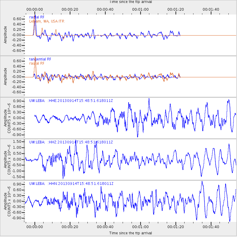
LEBA Lebam, WA, USA - Earthquake Result Viewer
*The percent match for this event was below the threshold and hence no stack was calculated.
| Earthquake location: |
Andreanof Islands, Aleutian Is. |
| Earthquake latitude/longitude: |
51.4/-174.6 |
| Earthquake time(UTC): |
2013/09/14 (257) 15:42:46 GMT |
| Earthquake Depth: |
20 km |
| Earthquake Magnitude: |
5.9 MWW, 5.4 MI, 5.8 MWB, 5.9 MWC, 6.0 MWC |
| Earthquake Catalog/Contributor: |
NEIC PDE/NEIC COMCAT |
|
| Network: |
UW Pacific Northwest Regional Seismic Network |
| Station: |
LEBA Lebam, WA, USA |
| Lat/Lon: |
46.55 N/123.56 W |
| Elevation: |
73 m |
|
| Distance: |
33.3 deg |
| Az: |
77.942 deg |
| Baz: |
297.522 deg |
| Ray Param: |
$rayparam |
*The percent match for this event was below the threshold and hence was not used in the summary stack. |
|
| Radial Match: |
79.161644 % |
| Radial Bump: |
400 |
| Transverse Match: |
71.21724 % |
| Transverse Bump: |
400 |
| SOD ConfigId: |
626651 |
| Insert Time: |
2014-04-18 16:48:39.187 +0000 |
| GWidth: |
2.5 |
| Max Bumps: |
400 |
| Tol: |
0.001 |
|
Signal To Noise
| Channel | StoN | STA | LTA |
| UW:LEBA: :HHZ:20130914T15:48:51.618011Z | 2.695415 | 3.0275578E-7 | 1.123225E-7 |
| UW:LEBA: :HHN:20130914T15:48:51.618011Z | 0.6826622 | 1.04295836E-7 | 1.527781E-7 |
| UW:LEBA: :HHE:20130914T15:48:51.618011Z | 1.8353783 | 2.0018622E-7 | 1.09070825E-7 |
| Arrivals |
| Ps | |
| PpPs | |
| PsPs/PpSs | |


