YACT Amboy, WA, USA - Earthquake Result Viewer
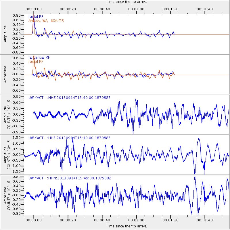
Earthquake location: Andreanof Islands, Aleutian Is.
Earthquake latitude/longitude: 51.4/-174.6
Earthquake time(UTC): 2013/09/14 (257) 15:42:46 GMT
Earthquake Depth: 20 km
Earthquake Magnitude: 5.9 MWW, 5.4 MI, 5.8 MWB, 5.9 MWC, 6.0 MWC
Earthquake Catalog/Contributor: NEIC PDE/NEIC COMCAT
Network: UW Pacific Northwest Regional Seismic Network
Station: YACT Amboy, WA, USA
Lat/Lon: 45.93 N/122.42 W
Elevation: 211 m
Distance: 34.3 deg
Az: 78.244 deg
Baz: 298.596 deg
Ray Param: 0.07779344
Estimated Moho Depth: 52.25 km
Estimated Crust Vp/Vs: 1.74
Assumed Crust Vp: 6.566 km/s
Estimated Crust Vs: 3.779 km/s
Estimated Crust Poisson's Ratio: 0.25
Radial Match: 86.26528 %
Radial Bump: 337
Transverse Match: 68.216644 %
Transverse Bump: 400
SOD ConfigId: 626651
Insert Time: 2014-04-18 16:49:09.148 +0000
GWidth: 2.5
Max Bumps: 400
Tol: 0.001

Signal To Noise

ChannelStoNSTALTA
UW:YACT: :HHZ:20130914T15:49:00.187988Z2.5007242.3734798E-79.49117E-8
UW:YACT: :HHN:20130914T15:49:00.187988Z0.700867358.950876E-81.2771142E-7
UW:YACT: :HHE:20130914T15:49:00.187988Z1.4712061.6321661E-71.109407E-7
Arrivals
Ps6.4 SECOND
PpPs20 SECOND
PsPs/PpSs26 SECOND