LCAR Lake Charles,AR - Earthquake Result Viewer
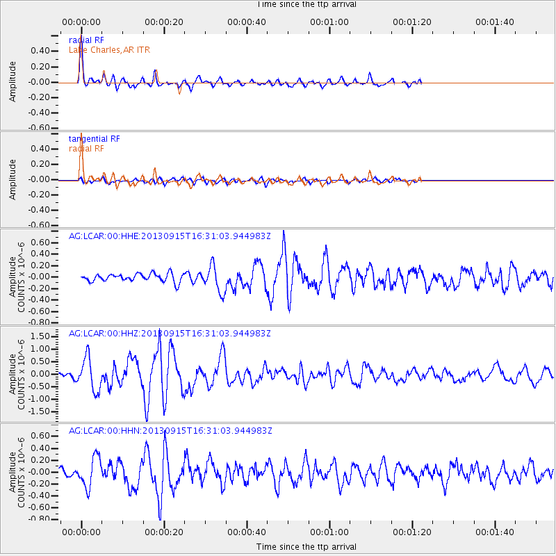
Earthquake location: Andreanof Islands, Aleutian Is.
Earthquake latitude/longitude: 51.6/-174.7
Earthquake time(UTC): 2013/09/15 (258) 16:21:37 GMT
Earthquake Depth: 24 km
Earthquake Magnitude: 6.1 MWW, 5.7 MI, 5.7 ML, 6.0 MWB, 6.1 MWC, 6.1 MWW
Earthquake Catalog/Contributor: NEIC PDE/NEIC COMCAT
Network: AG Arkansas Seismic Network
Station: LCAR Lake Charles,AR
Lat/Lon: 36.07 N/91.15 W
Elevation: 103 m
Distance: 59.0 deg
Az: 69.886 deg
Baz: 313.673 deg
Ray Param: 0.062430765
Estimated Moho Depth: 43.75 km
Estimated Crust Vp/Vs: 1.82
Assumed Crust Vp: 6.53 km/s
Estimated Crust Vs: 3.593 km/s
Estimated Crust Poisson's Ratio: 0.28
Radial Match: 87.202774 %
Radial Bump: 339
Transverse Match: 58.078003 %
Transverse Bump: 400
SOD ConfigId: 626651
Insert Time: 2014-04-18 16:53:03.251 +0000
GWidth: 2.5
Max Bumps: 400
Tol: 0.001

Signal To Noise

ChannelStoNSTALTA
AG:LCAR:00:HHZ:20130915T16:31:03.944983Z8.6169656.690662E-77.7645225E-8
AG:LCAR:00:HHN:20130915T16:31:03.944983Z3.4989342.5654984E-77.332228E-8
AG:LCAR:00:HHE:20130915T16:31:03.944983Z3.33144282.313115E-76.943283E-8
Arrivals
Ps5.7 SECOND
PpPs18 SECOND
PsPs/PpSs24 SECOND