
UTMT Martin, TN - Earthquake Result Viewer
| ||||||||||||||||||
| ||||||||||||||||||
| ||||||||||||||||||
|
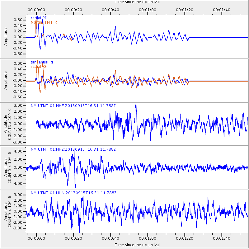
Signal To Noise
| Channel | StoN | STA | LTA |
| NM:UTMT:01:HHZ:20130915T16:31:11.788Z | 3.6011662 | 1.133645E-6 | 3.147994E-7 |
| NM:UTMT:01:HHN:20130915T16:31:11.788Z | 1.1175501 | 6.780915E-7 | 6.0676604E-7 |
| NM:UTMT:01:HHE:20130915T16:31:11.788Z | 1.0213523 | 4.3203468E-7 | 4.230026E-7 |
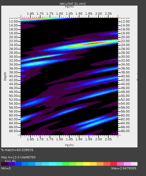
| Arrivals | |
| Ps | 1.0 SECOND |
| PpPs | 3.8 SECOND |
| PsPs/PpSs | 4.8 SECOND |

