255A Hazlehurst, GA, USA - Earthquake Result Viewer
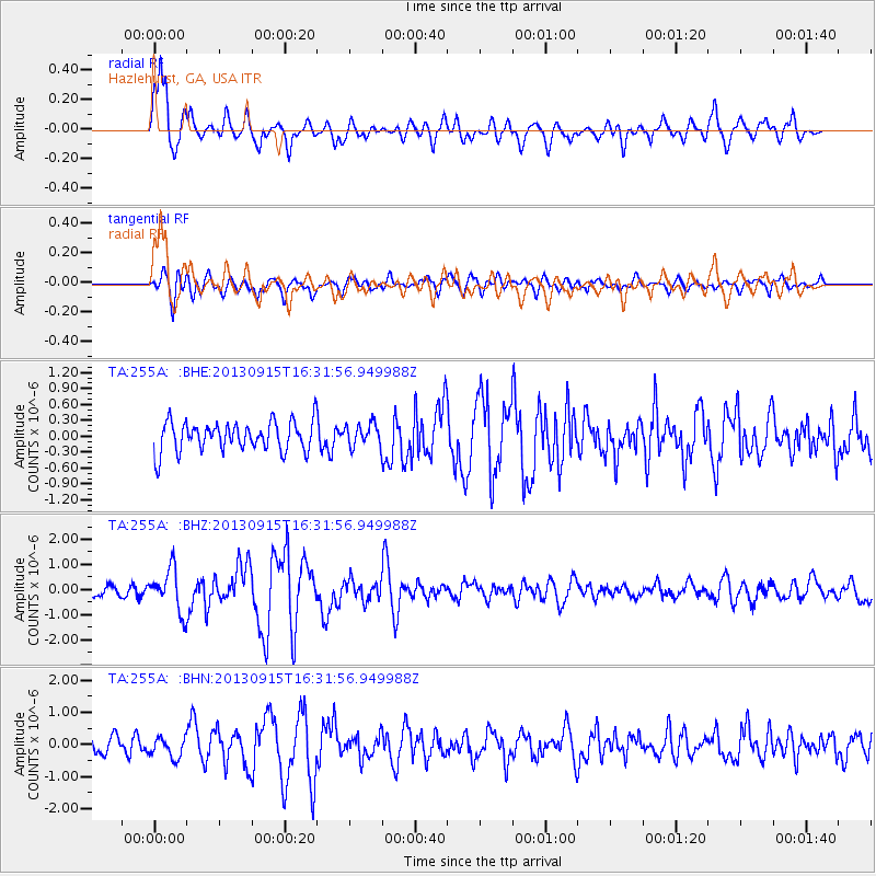
Earthquake location: Andreanof Islands, Aleutian Is.
Earthquake latitude/longitude: 51.6/-174.7
Earthquake time(UTC): 2013/09/15 (258) 16:21:37 GMT
Earthquake Depth: 24 km
Earthquake Magnitude: 6.1 MWW, 5.7 MI, 5.7 ML, 6.0 MWB, 6.1 MWC, 6.1 MWW
Earthquake Catalog/Contributor: NEIC PDE/NEIC COMCAT
Network: TA USArray Transportable Network (new EarthScope stations)
Station: 255A Hazlehurst, GA, USA
Lat/Lon: 31.93 N/82.48 W
Elevation: 45 m
Distance: 67.0 deg
Az: 67.359 deg
Baz: 317.363 deg
Ray Param: 0.05720148
Estimated Moho Depth: 13.75 km
Estimated Crust Vp/Vs: 1.82
Assumed Crust Vp: 6.565 km/s
Estimated Crust Vs: 3.612 km/s
Estimated Crust Poisson's Ratio: 0.28
Radial Match: 87.96209 %
Radial Bump: 400
Transverse Match: 63.669262 %
Transverse Bump: 400
SOD ConfigId: 626651
Insert Time: 2014-04-18 17:19:07.892 +0000
GWidth: 2.5
Max Bumps: 400
Tol: 0.001

Signal To Noise

ChannelStoNSTALTA
TA:255A: :BHZ:20130915T16:31:56.949988Z5.38556438.4250644E-71.564379E-7
TA:255A: :BHN:20130915T16:31:56.949988Z1.30061353.1234072E-72.4014875E-7
TA:255A: :BHE:20130915T16:31:56.949988Z0.765390462.1241323E-72.775227E-7
Arrivals
Ps1.8 SECOND
PpPs5.7 SECOND
PsPs/PpSs7.4 SECOND