352A Blakely, GA, USA - Earthquake Result Viewer
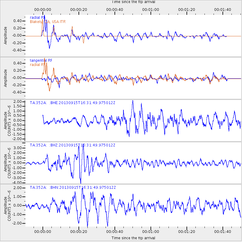
Earthquake location: Andreanof Islands, Aleutian Is.
Earthquake latitude/longitude: 51.6/-174.7
Earthquake time(UTC): 2013/09/15 (258) 16:21:37 GMT
Earthquake Depth: 24 km
Earthquake Magnitude: 6.1 MWW, 5.7 MI, 5.7 ML, 6.0 MWB, 6.1 MWC, 6.1 MWW
Earthquake Catalog/Contributor: NEIC PDE/NEIC COMCAT
Network: TA USArray Transportable Network (new EarthScope stations)
Station: 352A Blakely, GA, USA
Lat/Lon: 31.48 N/84.93 W
Elevation: 101 m
Distance: 65.9 deg
Az: 69.36 deg
Baz: 316.88 deg
Ray Param: 0.057924334
Estimated Moho Depth: 13.75 km
Estimated Crust Vp/Vs: 2.03
Assumed Crust Vp: 6.347 km/s
Estimated Crust Vs: 3.134 km/s
Estimated Crust Poisson's Ratio: 0.34
Radial Match: 92.56342 %
Radial Bump: 377
Transverse Match: 77.650154 %
Transverse Bump: 400
SOD ConfigId: 626651
Insert Time: 2014-04-18 17:19:13.747 +0000
GWidth: 2.5
Max Bumps: 400
Tol: 0.001

Signal To Noise

ChannelStoNSTALTA
TA:352A: :BHZ:20130915T16:31:49.975012Z8.6586629.2195216E-71.06477444E-7
TA:352A: :BHN:20130915T16:31:49.975012Z1.42251242.2224941E-71.5623723E-7
TA:352A: :BHE:20130915T16:31:49.975012Z1.40857113.5629634E-72.5294878E-7
Arrivals
Ps2.3 SECOND
PpPs6.3 SECOND
PsPs/PpSs8.6 SECOND