355A Pearson, GA, USA - Earthquake Result Viewer
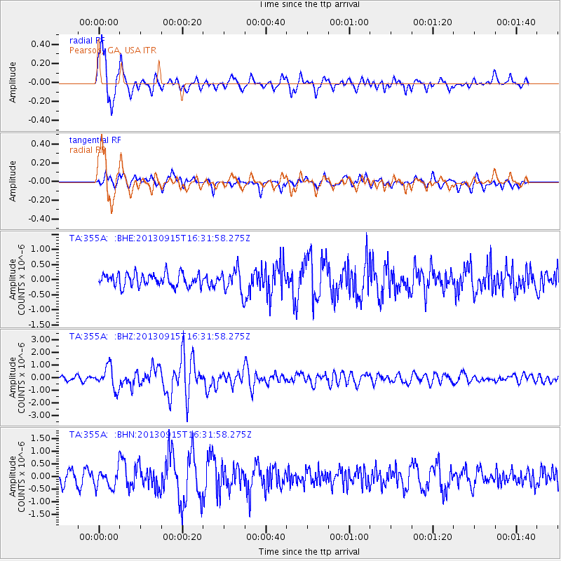
Earthquake location: Andreanof Islands, Aleutian Is.
Earthquake latitude/longitude: 51.6/-174.7
Earthquake time(UTC): 2013/09/15 (258) 16:21:37 GMT
Earthquake Depth: 24 km
Earthquake Magnitude: 6.1 MWW, 5.7 MI, 5.7 ML, 6.0 MWB, 6.1 MWC, 6.1 MWW
Earthquake Catalog/Contributor: NEIC PDE/NEIC COMCAT
Network: TA USArray Transportable Network (new EarthScope stations)
Station: 355A Pearson, GA, USA
Lat/Lon: 31.34 N/82.85 W
Elevation: 69 m
Distance: 67.2 deg
Az: 68.042 deg
Baz: 317.433 deg
Ray Param: 0.057064436
Estimated Moho Depth: 16.5 km
Estimated Crust Vp/Vs: 1.61
Assumed Crust Vp: 6.565 km/s
Estimated Crust Vs: 4.09 km/s
Estimated Crust Poisson's Ratio: 0.18
Radial Match: 88.8333 %
Radial Bump: 400
Transverse Match: 66.19752 %
Transverse Bump: 400
SOD ConfigId: 626651
Insert Time: 2014-04-18 17:19:20.443 +0000
GWidth: 2.5
Max Bumps: 400
Tol: 0.001

Signal To Noise

ChannelStoNSTALTA
TA:355A: :BHZ:20130915T16:31:58.275Z6.96600159.0509093E-71.2992976E-7
TA:355A: :BHN:20130915T16:31:58.275Z1.51896453.5485402E-72.3361575E-7
TA:355A: :BHE:20130915T16:31:58.275Z1.89574963.9688157E-72.0935339E-7
Arrivals
Ps1.6 SECOND
PpPs6.3 SECOND
PsPs/PpSs7.8 SECOND