356A Blackshear, GA, USA - Earthquake Result Viewer
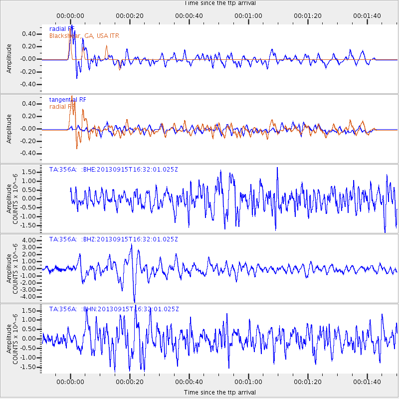
Earthquake location: Andreanof Islands, Aleutian Is.
Earthquake latitude/longitude: 51.6/-174.7
Earthquake time(UTC): 2013/09/15 (258) 16:21:37 GMT
Earthquake Depth: 24 km
Earthquake Magnitude: 6.1 MWW, 5.7 MI, 5.7 ML, 6.0 MWB, 6.1 MWC, 6.1 MWW
Earthquake Catalog/Contributor: NEIC PDE/NEIC COMCAT
Network: TA USArray Transportable Network (new EarthScope stations)
Station: 356A Blackshear, GA, USA
Lat/Lon: 31.32 N/82.13 W
Elevation: 36 m
Distance: 67.7 deg
Az: 67.561 deg
Baz: 317.623 deg
Ray Param: 0.056782663
Estimated Moho Depth: 13.0 km
Estimated Crust Vp/Vs: 1.73
Assumed Crust Vp: 6.565 km/s
Estimated Crust Vs: 3.8 km/s
Estimated Crust Poisson's Ratio: 0.25
Radial Match: 87.12647 %
Radial Bump: 400
Transverse Match: 57.304752 %
Transverse Bump: 400
SOD ConfigId: 626651
Insert Time: 2014-04-18 17:19:26.327 +0000
GWidth: 2.5
Max Bumps: 400
Tol: 0.001

Signal To Noise

ChannelStoNSTALTA
TA:356A: :BHZ:20130915T16:32:01.025Z5.0276121.00788E-62.0046892E-7
TA:356A: :BHN:20130915T16:32:01.025Z1.54905653.6748486E-72.372314E-7
TA:356A: :BHE:20130915T16:32:01.025Z1.10803433.6937865E-73.3336394E-7
Arrivals
Ps1.5 SECOND
PpPs5.2 SECOND
PsPs/PpSs6.7 SECOND