
455A Stateville, GA, USA - Earthquake Result Viewer
| ||||||||||||||||||
| ||||||||||||||||||
| ||||||||||||||||||
|
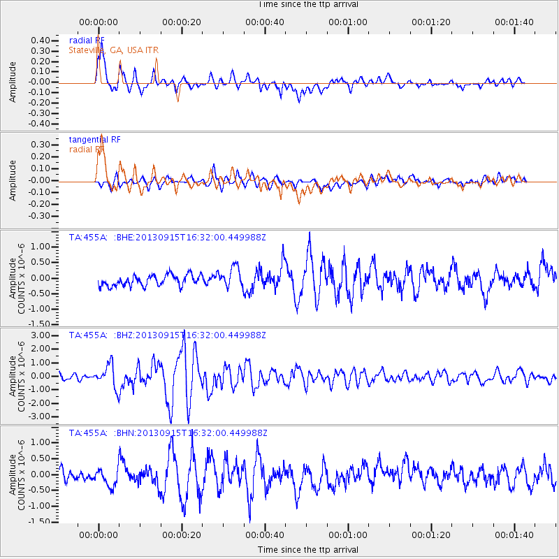
Signal To Noise
| Channel | StoN | STA | LTA |
| TA:455A: :BHZ:20130915T16:32:00.449988Z | 4.3613186 | 8.8937765E-7 | 2.0392403E-7 |
| TA:455A: :BHN:20130915T16:32:00.449988Z | 1.5948781 | 3.0158415E-7 | 1.8909543E-7 |
| TA:455A: :BHE:20130915T16:32:00.449988Z | 1.9230994 | 3.3706363E-7 | 1.7527104E-7 |
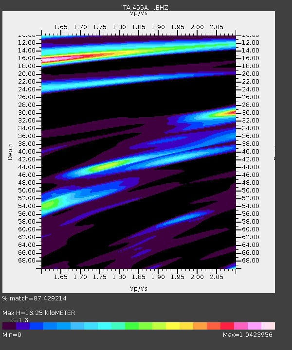
| Arrivals | |
| Ps | 1.6 SECOND |
| PpPs | 6.1 SECOND |
| PsPs/PpSs | 7.7 SECOND |

