BGNE Belgrade, NE, USA - Earthquake Result Viewer
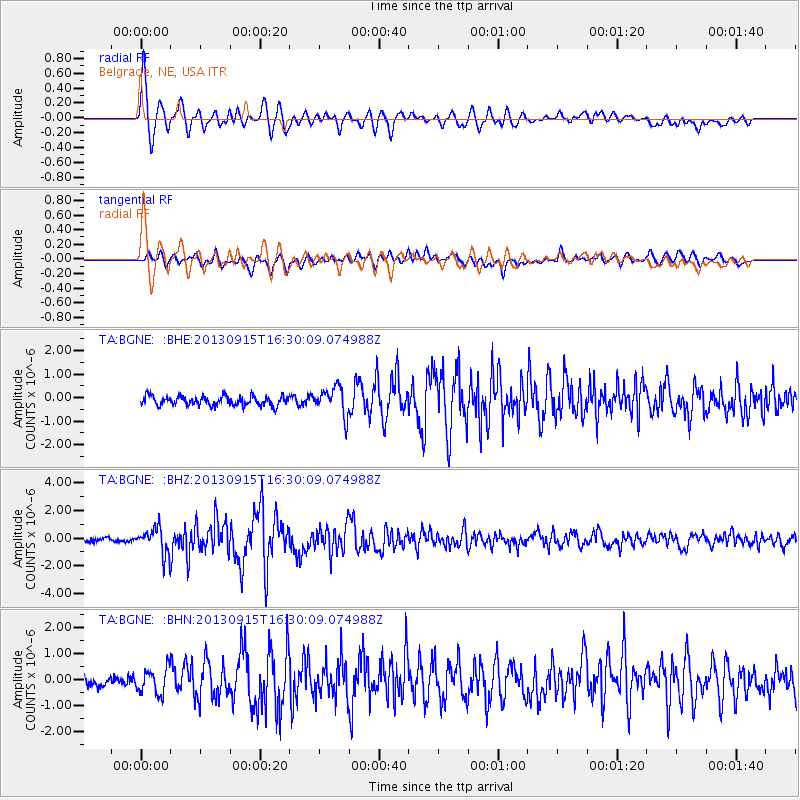
Earthquake location: Andreanof Islands, Aleutian Is.
Earthquake latitude/longitude: 51.6/-174.7
Earthquake time(UTC): 2013/09/15 (258) 16:21:37 GMT
Earthquake Depth: 24 km
Earthquake Magnitude: 6.1 MWW, 5.7 MI, 5.7 ML, 6.0 MWB, 6.1 MWC, 6.1 MWW
Earthquake Catalog/Contributor: NEIC PDE/NEIC COMCAT
Network: TA USArray Transportable Network (new EarthScope stations)
Station: BGNE Belgrade, NE, USA
Lat/Lon: 41.41 N/98.15 W
Elevation: 573 m
Distance: 51.4 deg
Az: 69.425 deg
Baz: 309.041 deg
Ray Param: 0.06740565
Estimated Moho Depth: 10.0 km
Estimated Crust Vp/Vs: 1.60
Assumed Crust Vp: 6.53 km/s
Estimated Crust Vs: 4.082 km/s
Estimated Crust Poisson's Ratio: 0.18
Radial Match: 91.49129 %
Radial Bump: 400
Transverse Match: 73.90108 %
Transverse Bump: 400
SOD ConfigId: 626651
Insert Time: 2014-04-18 17:20:16.831 +0000
GWidth: 2.5
Max Bumps: 400
Tol: 0.001

Signal To Noise

ChannelStoNSTALTA
TA:BGNE: :BHZ:20130915T16:30:09.074988Z6.2904629.22079E-71.4658367E-7
TA:BGNE: :BHN:20130915T16:30:09.074988Z2.3619984.786158E-72.0263174E-7
TA:BGNE: :BHE:20130915T16:30:09.074988Z3.00835926.007911E-71.9970724E-7
Arrivals
Ps1.0 SECOND
PpPs3.7 SECOND
PsPs/PpSs4.7 SECOND