C06D Leavenworth, WQ, USA - Earthquake Result Viewer
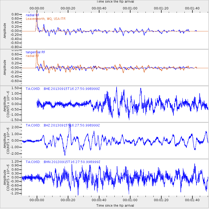
Earthquake location: Andreanof Islands, Aleutian Is.
Earthquake latitude/longitude: 51.6/-174.7
Earthquake time(UTC): 2013/09/15 (258) 16:21:37 GMT
Earthquake Depth: 24 km
Earthquake Magnitude: 6.1 MWW, 5.7 MI, 5.7 ML, 6.0 MWB, 6.1 MWC, 6.1 MWW
Earthquake Catalog/Contributor: NEIC PDE/NEIC COMCAT
Network: TA USArray Transportable Network (new EarthScope stations)
Station: C06D Leavenworth, WQ, USA
Lat/Lon: 47.92 N/120.89 W
Elevation: 544 m
Distance: 34.3 deg
Az: 74.403 deg
Baz: 296.666 deg
Ray Param: 0.07777312
Estimated Moho Depth: 35.75 km
Estimated Crust Vp/Vs: 1.80
Assumed Crust Vp: 6.597 km/s
Estimated Crust Vs: 3.67 km/s
Estimated Crust Poisson's Ratio: 0.28
Radial Match: 92.83507 %
Radial Bump: 400
Transverse Match: 71.96179 %
Transverse Bump: 400
SOD ConfigId: 626651
Insert Time: 2014-04-18 17:20:25.291 +0000
GWidth: 2.5
Max Bumps: 400
Tol: 0.001

Signal To Noise

ChannelStoNSTALTA
TA:C06D: :BHZ:20130915T16:27:50.998999Z3.54133423.6292872E-71.0248361E-7
TA:C06D: :BHN:20130915T16:27:50.998999Z1.3429511.7185613E-71.2796902E-7
TA:C06D: :BHE:20130915T16:27:50.998999Z1.15628281.8650542E-71.6129741E-7
Arrivals
Ps4.7 SECOND
PpPs14 SECOND
PsPs/PpSs19 SECOND