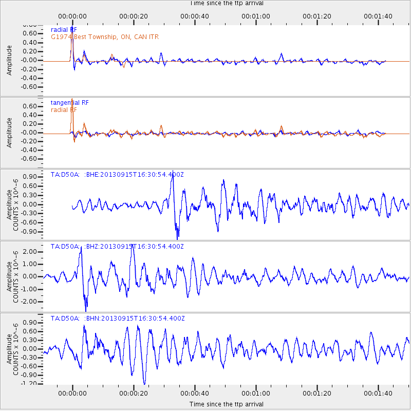
D50A G1974 Best Township, ON, CAN - Earthquake Result Viewer
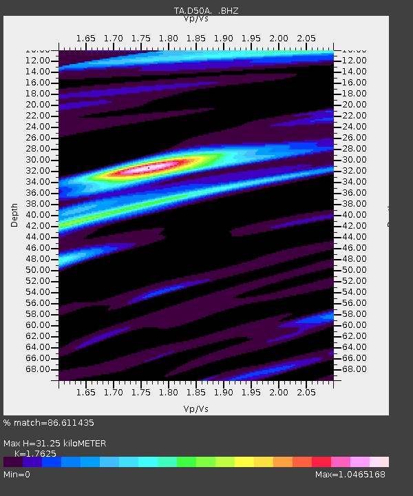
Earthquake location: Andreanof Islands, Aleutian Is.
Earthquake latitude/longitude: 51.6/-174.7
Earthquake time(UTC): 2013/09/15 (258) 16:21:37 GMT
Earthquake Depth: 24 km
Earthquake Magnitude: 6.1 MWW, 5.7 MI, 5.7 ML, 6.0 MWB, 6.1 MWC, 6.1 MWW
Earthquake Catalog/Contributor: NEIC PDE/NEIC COMCAT
Network: TA USArray Transportable Network (new EarthScope stations)
Station: D50A G1974 Best Township, ON, CAN
Lat/Lon: 47.17 N/79.84 W
Elevation: 331 m
Distance: 57.7 deg
Az: 53.584 deg
Baz: 312.608 deg
Ray Param: 0.06332085
Estimated Moho Depth: 31.25 km
Estimated Crust Vp/Vs: 1.76
Assumed Crust Vp: 6.622 km/s
Estimated Crust Vs: 3.757 km/s
Estimated Crust Poisson's Ratio: 0.26
Radial Match: 86.611435 %
Radial Bump: 400
Transverse Match: 63.54734 %
Transverse Bump: 400
SOD ConfigId: 626651
Insert Time: 2014-04-18 17:20:54.723 +0000
GWidth: 2.5
Max Bumps: 400
Tol: 0.001

Signal To Noise

ChannelStoNSTALTA
TA:D50A: :BHZ:20130915T16:30:54.400Z6.26685521.2918173E-62.0613486E-7
TA:D50A: :BHN:20130915T16:30:54.400Z2.86824584.0342255E-71.4065131E-7
TA:D50A: :BHE:20130915T16:30:54.400Z5.78921655.647317E-79.7548906E-8
Arrivals
Ps3.8 SECOND
PpPs12 SECOND
PsPs/PpSs16 SECOND