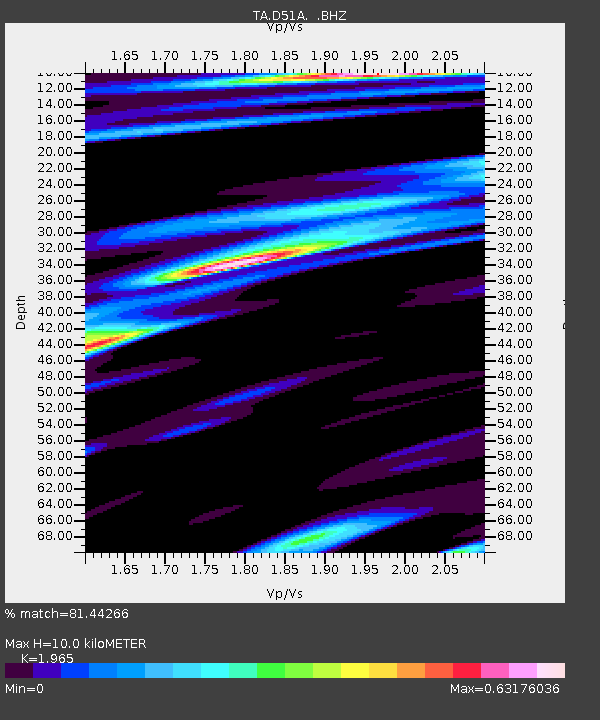
D51A Lot 18 Range III Mazenod Township, QC, CAN - Earthquake Result Viewer
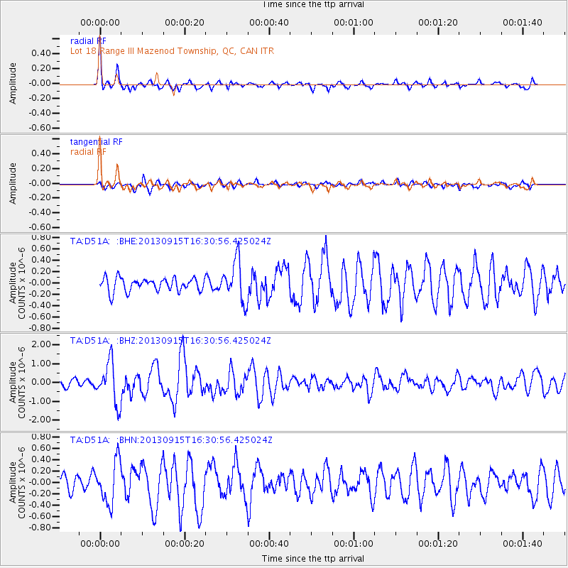
Earthquake location: Andreanof Islands, Aleutian Is.
Earthquake latitude/longitude: 51.6/-174.7
Earthquake time(UTC): 2013/09/15 (258) 16:21:37 GMT
Earthquake Depth: 24 km
Earthquake Magnitude: 6.1 MWW, 5.7 MI, 5.7 ML, 6.0 MWB, 6.1 MWC, 6.1 MWW
Earthquake Catalog/Contributor: NEIC PDE/NEIC COMCAT
Network: TA USArray Transportable Network (new EarthScope stations)
Station: D51A Lot 18 Range III Mazenod Township, QC, CAN
Lat/Lon: 47.09 N/79.37 W
Elevation: 282 m
Distance: 57.9 deg
Az: 53.394 deg
Baz: 312.848 deg
Ray Param: 0.06313582
Estimated Moho Depth: 10.0 km
Estimated Crust Vp/Vs: 1.97
Assumed Crust Vp: 6.622 km/s
Estimated Crust Vs: 3.37 km/s
Estimated Crust Poisson's Ratio: 0.33
Radial Match: 81.44266 %
Radial Bump: 388
Transverse Match: 73.28874 %
Transverse Bump: 400
SOD ConfigId: 626651
Insert Time: 2014-04-18 17:20:54.891 +0000
GWidth: 2.5
Max Bumps: 400
Tol: 0.001

Signal To Noise

ChannelStoNSTALTA
TA:D51A: :BHZ:20130915T16:30:56.425024Z5.5498471.1295128E-62.0352144E-7
TA:D51A: :BHN:20130915T16:30:56.425024Z2.01457293.7865289E-71.8795689E-7
TA:D51A: :BHE:20130915T16:30:56.425024Z3.25713563.7898886E-71.1635648E-7
Arrivals
Ps1.5 SECOND
PpPs4.3 SECOND
PsPs/PpSs5.8 SECOND