G55A Calabogie, ON, CAN - Earthquake Result Viewer
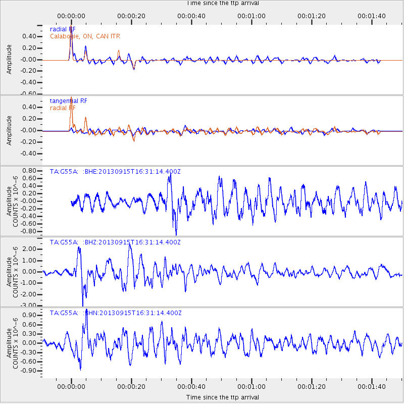
Earthquake location: Andreanof Islands, Aleutian Is.
Earthquake latitude/longitude: 51.6/-174.7
Earthquake time(UTC): 2013/09/15 (258) 16:21:37 GMT
Earthquake Depth: 24 km
Earthquake Magnitude: 6.1 MWW, 5.7 MI, 5.7 ML, 6.0 MWB, 6.1 MWC, 6.1 MWW
Earthquake Catalog/Contributor: NEIC PDE/NEIC COMCAT
Network: TA USArray Transportable Network (new EarthScope stations)
Station: G55A Calabogie, ON, CAN
Lat/Lon: 45.25 N/76.72 W
Elevation: 228 m
Distance: 60.5 deg
Az: 53.451 deg
Baz: 314.787 deg
Ray Param: 0.061430294
Estimated Moho Depth: 40.25 km
Estimated Crust Vp/Vs: 1.76
Assumed Crust Vp: 6.577 km/s
Estimated Crust Vs: 3.737 km/s
Estimated Crust Poisson's Ratio: 0.26
Radial Match: 87.898476 %
Radial Bump: 383
Transverse Match: 62.14789 %
Transverse Bump: 400
SOD ConfigId: 626651
Insert Time: 2014-04-18 17:23:08.863 +0000
GWidth: 2.5
Max Bumps: 400
Tol: 0.001

Signal To Noise

ChannelStoNSTALTA
TA:G55A: :BHZ:20130915T16:31:14.400Z8.2734591.2611046E-61.5242772E-7
TA:G55A: :BHN:20130915T16:31:14.400Z4.92048174.1949286E-78.525443E-8
TA:G55A: :BHE:20130915T16:31:14.400Z2.81855563.6087854E-71.2803669E-7
Arrivals
Ps4.9 SECOND
PpPs16 SECOND
PsPs/PpSs21 SECOND