H04D Lebanon, OR, USA - Earthquake Result Viewer
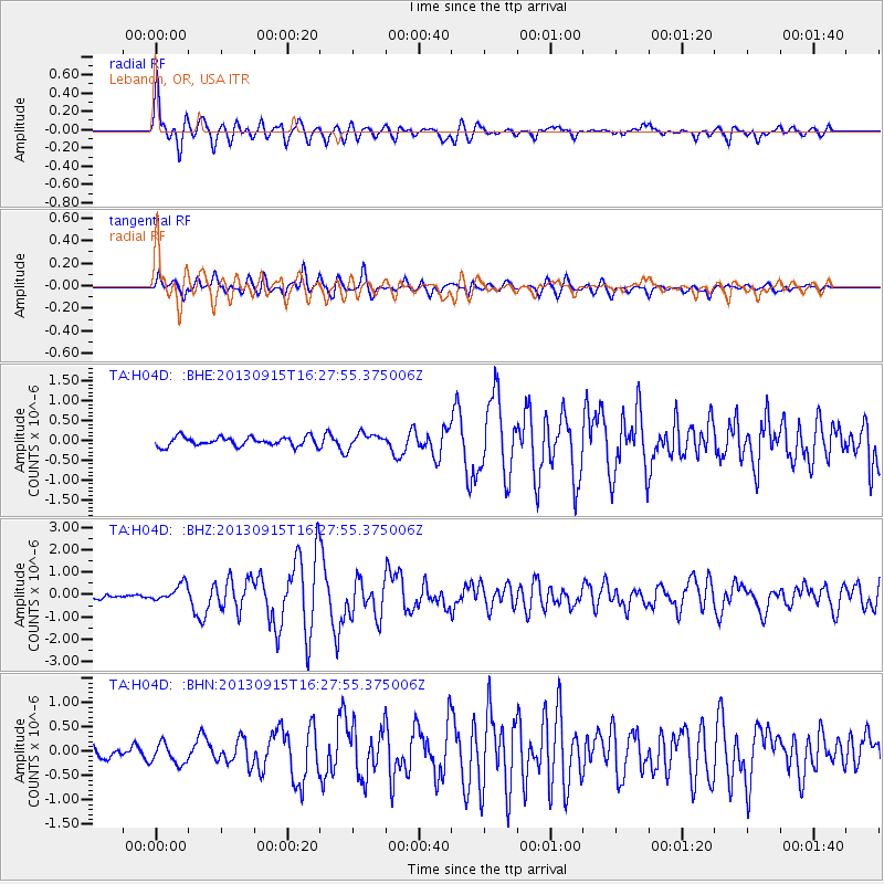
Earthquake location: Andreanof Islands, Aleutian Is.
Earthquake latitude/longitude: 51.6/-174.7
Earthquake time(UTC): 2013/09/15 (258) 16:21:37 GMT
Earthquake Depth: 24 km
Earthquake Magnitude: 6.1 MWW, 5.7 MI, 5.7 ML, 6.0 MWB, 6.1 MWC, 6.1 MWW
Earthquake Catalog/Contributor: NEIC PDE/NEIC COMCAT
Network: TA USArray Transportable Network (new EarthScope stations)
Station: H04D Lebanon, OR, USA
Lat/Lon: 44.52 N/122.74 W
Elevation: 284 m
Distance: 34.8 deg
Az: 80.747 deg
Baz: 300.564 deg
Ray Param: 0.07751195
Estimated Moho Depth: 56.75 km
Estimated Crust Vp/Vs: 1.74
Assumed Crust Vp: 6.566 km/s
Estimated Crust Vs: 3.779 km/s
Estimated Crust Poisson's Ratio: 0.25
Radial Match: 89.26818 %
Radial Bump: 400
Transverse Match: 73.25214 %
Transverse Bump: 400
SOD ConfigId: 626651
Insert Time: 2014-04-18 17:23:22.834 +0000
GWidth: 2.5
Max Bumps: 400
Tol: 0.001

Signal To Noise

ChannelStoNSTALTA
TA:H04D: :BHZ:20130915T16:27:55.375006Z3.5534283.8075547E-71.0715159E-7
TA:H04D: :BHN:20130915T16:27:55.375006Z2.21037772.1390332E-79.67723E-8
TA:H04D: :BHE:20130915T16:27:55.375006Z1.55729451.7909103E-71.1500139E-7
Arrivals
Ps6.9 SECOND
PpPs22 SECOND
PsPs/PpSs29 SECOND