I42A Draeger Farm, Ripon, WI, USA - Earthquake Result Viewer
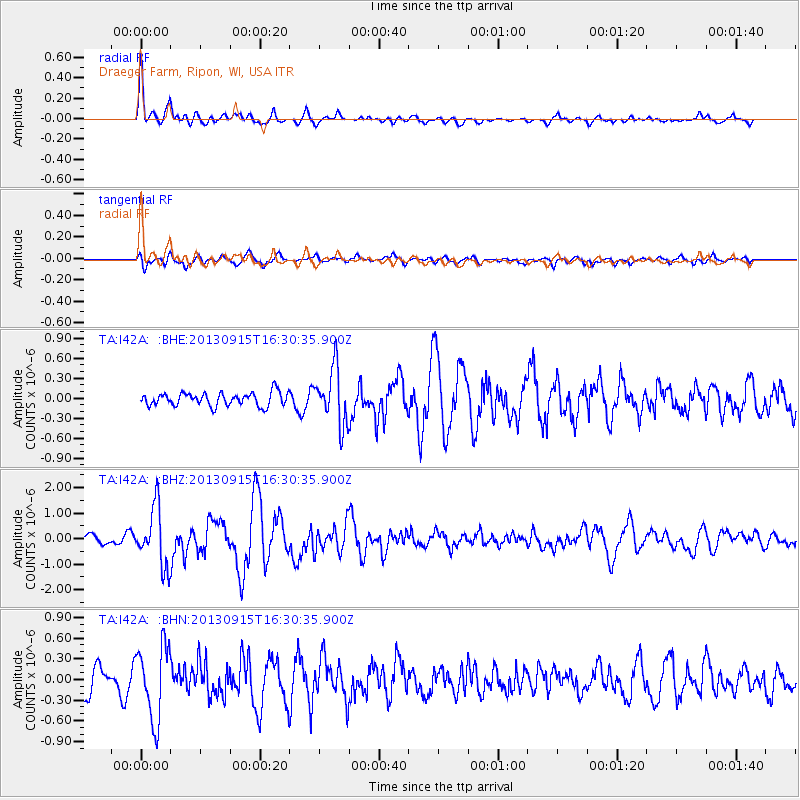
Earthquake location: Andreanof Islands, Aleutian Is.
Earthquake latitude/longitude: 51.6/-174.7
Earthquake time(UTC): 2013/09/15 (258) 16:21:37 GMT
Earthquake Depth: 24 km
Earthquake Magnitude: 6.1 MWW, 5.7 MI, 5.7 ML, 6.0 MWB, 6.1 MWC, 6.1 MWW
Earthquake Catalog/Contributor: NEIC PDE/NEIC COMCAT
Network: TA USArray Transportable Network (new EarthScope stations)
Station: I42A Draeger Farm, Ripon, WI, USA
Lat/Lon: 43.89 N/88.91 W
Elevation: 298 m
Distance: 55.1 deg
Az: 61.605 deg
Baz: 310.596 deg
Ray Param: 0.06501439
Estimated Moho Depth: 39.5 km
Estimated Crust Vp/Vs: 1.76
Assumed Crust Vp: 6.571 km/s
Estimated Crust Vs: 3.723 km/s
Estimated Crust Poisson's Ratio: 0.26
Radial Match: 87.47574 %
Radial Bump: 400
Transverse Match: 61.1103 %
Transverse Bump: 400
SOD ConfigId: 626651
Insert Time: 2014-04-18 17:24:17.470 +0000
GWidth: 2.5
Max Bumps: 400
Tol: 0.001

Signal To Noise

ChannelStoNSTALTA
TA:I42A: :BHZ:20130915T16:30:35.900Z5.86321.150146E-61.9616351E-7
TA:I42A: :BHN:20130915T16:30:35.900Z3.37368155.3992596E-71.6004059E-7
TA:I42A: :BHE:20130915T16:30:35.900Z4.1951784.1800158E-79.963858E-8
Arrivals
Ps4.9 SECOND
PpPs16 SECOND
PsPs/PpSs21 SECOND