
I52A Shelburne, ON, CAN - Earthquake Result Viewer
| ||||||||||||||||||
| ||||||||||||||||||
| ||||||||||||||||||
|
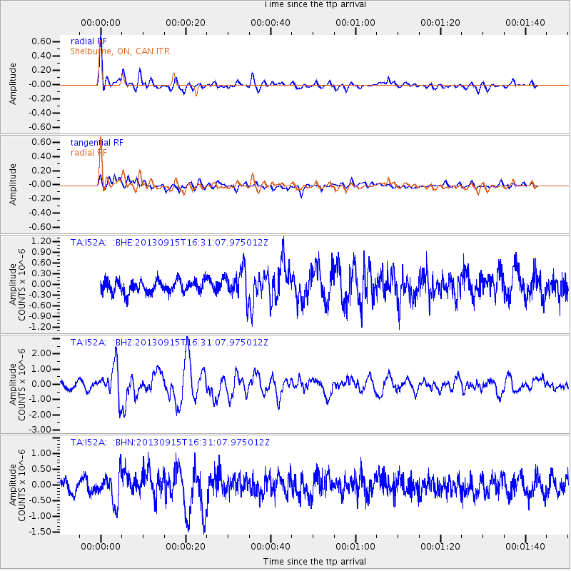
Signal To Noise
| Channel | StoN | STA | LTA |
| TA:I52A: :BHZ:20130915T16:31:07.975012Z | 5.899952 | 1.0921159E-6 | 1.8510589E-7 |
| TA:I52A: :BHN:20130915T16:31:07.975012Z | 2.2019026 | 4.6771487E-7 | 2.1241395E-7 |
| TA:I52A: :BHE:20130915T16:31:07.975012Z | 2.3674023 | 4.1826922E-7 | 1.7667855E-7 |
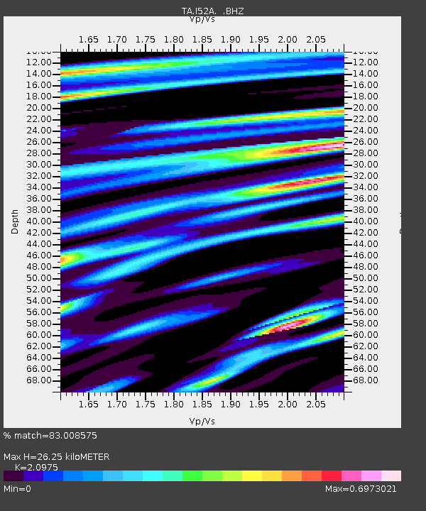
| Arrivals | |
| Ps | 4.6 SECOND |
| PpPs | 12 SECOND |
| PsPs/PpSs | 17 SECOND |

