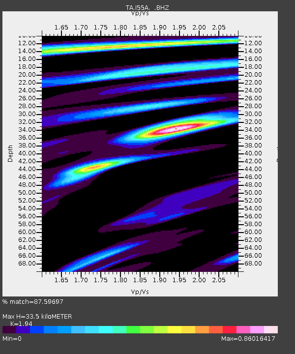
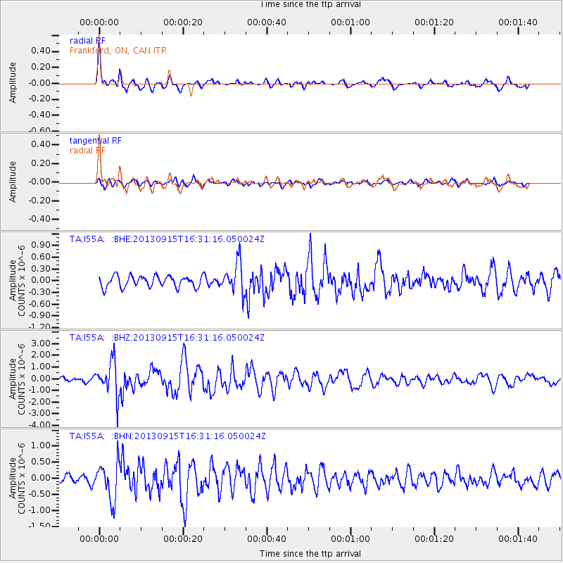
I55A Frankford, ON, CAN - Earthquake Result Viewer

Earthquake location: Andreanof Islands, Aleutian Is.
Earthquake latitude/longitude: 51.6/-174.7
Earthquake time(UTC): 2013/09/15 (258) 16:21:37 GMT
Earthquake Depth: 24 km
Earthquake Magnitude: 6.1 MWW, 5.7 MI, 5.7 ML, 6.0 MWB, 6.1 MWC, 6.1 MWW
Earthquake Catalog/Contributor: NEIC PDE/NEIC COMCAT
Network: TA USArray Transportable Network (new EarthScope stations)
Station: I55A Frankford, ON, CAN
Lat/Lon: 44.22 N/77.68 W
Elevation: 132 m
Distance: 60.8 deg
Az: 54.85 deg
Baz: 314.796 deg
Ray Param: 0.061269384
Estimated Moho Depth: 33.5 km
Estimated Crust Vp/Vs: 1.94
Assumed Crust Vp: 6.577 km/s
Estimated Crust Vs: 3.39 km/s
Estimated Crust Poisson's Ratio: 0.32
Radial Match: 87.59697 %
Radial Bump: 386
Transverse Match: 68.17868 %
Transverse Bump: 400
SOD ConfigId: 626651
Insert Time: 2014-04-18 17:24:47.053 +0000
GWidth: 2.5
Max Bumps: 400
Tol: 0.001

Signal To Noise

ChannelStoNSTALTA
TA:I55A: :BHZ:20130915T16:31:16.050024Z4.76594261.4916675E-63.1298475E-7
TA:I55A: :BHN:20130915T16:31:16.050024Z3.00116945.8522625E-71.9499942E-7
TA:I55A: :BHE:20130915T16:31:16.050024Z2.82704974.031702E-71.4261164E-7
Arrivals
Ps5.0 SECOND
PpPs14 SECOND
PsPs/PpSs19 SECOND