J54A Appleton, NY, USA - Earthquake Result Viewer
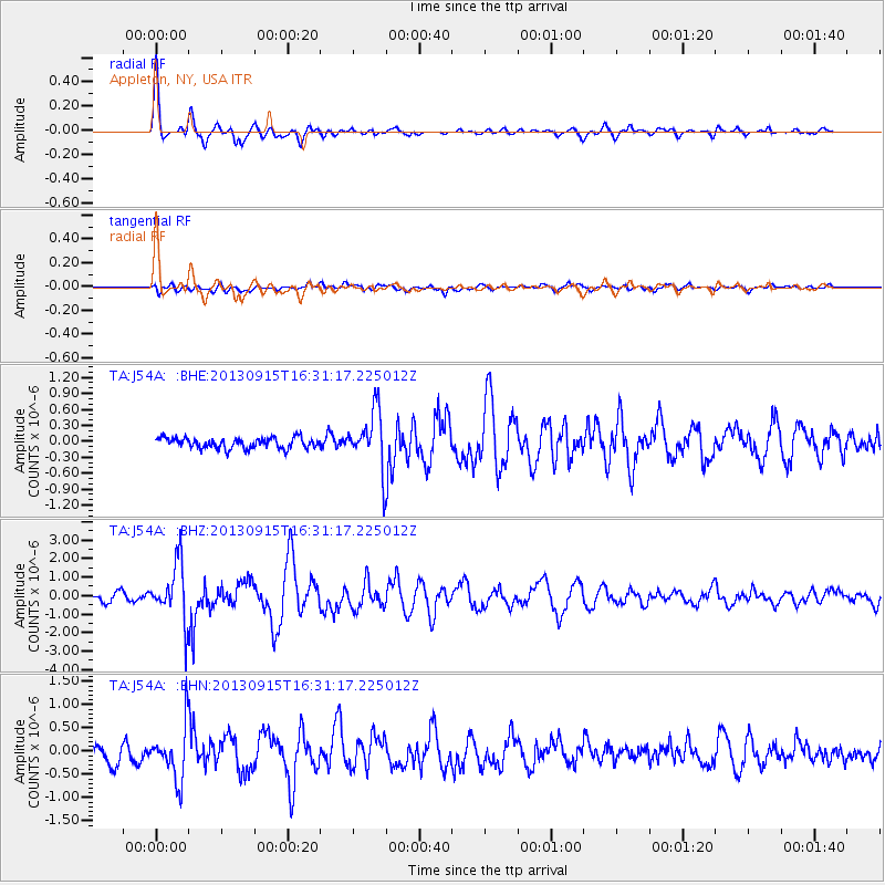
Earthquake location: Andreanof Islands, Aleutian Is.
Earthquake latitude/longitude: 51.6/-174.7
Earthquake time(UTC): 2013/09/15 (258) 16:21:37 GMT
Earthquake Depth: 24 km
Earthquake Magnitude: 6.1 MWW, 5.7 MI, 5.7 ML, 6.0 MWB, 6.1 MWC, 6.1 MWW
Earthquake Catalog/Contributor: NEIC PDE/NEIC COMCAT
Network: TA USArray Transportable Network (new EarthScope stations)
Station: J54A Appleton, NY, USA
Lat/Lon: 43.27 N/78.64 W
Elevation: 112 m
Distance: 61.0 deg
Az: 56.175 deg
Baz: 314.782 deg
Ray Param: 0.06115583
Estimated Moho Depth: 33.75 km
Estimated Crust Vp/Vs: 1.95
Assumed Crust Vp: 6.419 km/s
Estimated Crust Vs: 3.288 km/s
Estimated Crust Poisson's Ratio: 0.32
Radial Match: 86.75673 %
Radial Bump: 400
Transverse Match: 58.836906 %
Transverse Bump: 400
SOD ConfigId: 626651
Insert Time: 2014-04-18 17:25:30.478 +0000
GWidth: 2.5
Max Bumps: 400
Tol: 0.001

Signal To Noise

ChannelStoNSTALTA
TA:J54A: :BHZ:20130915T16:31:17.225012Z7.00245051.5226773E-62.174492E-7
TA:J54A: :BHN:20130915T16:31:17.225012Z3.12118155.5509537E-71.7784784E-7
TA:J54A: :BHE:20130915T16:31:17.225012Z5.37291865.3811533E-71.0015326E-7
Arrivals
Ps5.2 SECOND
PpPs15 SECOND
PsPs/PpSs20 SECOND