
J62A Henniker, NH, USA - Earthquake Result Viewer
| ||||||||||||||||||
| ||||||||||||||||||
| ||||||||||||||||||
|
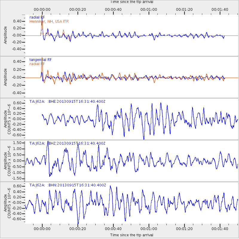
Signal To Noise
| Channel | StoN | STA | LTA |
| TA:J62A: :BHZ:20130915T16:31:40.400Z | 3.3437836 | 8.051644E-7 | 2.407944E-7 |
| TA:J62A: :BHN:20130915T16:31:40.400Z | 1.5314591 | 2.3372404E-7 | 1.5261527E-7 |
| TA:J62A: :BHE:20130915T16:31:40.400Z | 2.6060066 | 2.897829E-7 | 1.11198055E-7 |
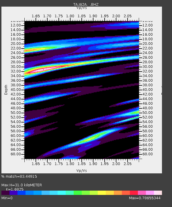
| Arrivals | |
| Ps | 3.4 SECOND |
| PpPs | 12 SECOND |
| PsPs/PpSs | 16 SECOND |

