J61A Chester, VT, USA - Earthquake Result Viewer
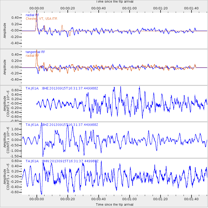
Earthquake location: Andreanof Islands, Aleutian Is.
Earthquake latitude/longitude: 51.6/-174.7
Earthquake time(UTC): 2013/09/15 (258) 16:21:37 GMT
Earthquake Depth: 24 km
Earthquake Magnitude: 6.1 MWW, 5.7 MI, 5.7 ML, 6.0 MWB, 6.1 MWC, 6.1 MWW
Earthquake Catalog/Contributor: NEIC PDE/NEIC COMCAT
Network: TA USArray Transportable Network (new EarthScope stations)
Station: J61A Chester, VT, USA
Lat/Lon: 43.35 N/72.55 W
Elevation: 253 m
Distance: 64.0 deg
Az: 52.515 deg
Baz: 317.251 deg
Ray Param: 0.059182823
Estimated Moho Depth: 26.0 km
Estimated Crust Vp/Vs: 2.10
Assumed Crust Vp: 6.419 km/s
Estimated Crust Vs: 3.064 km/s
Estimated Crust Poisson's Ratio: 0.35
Radial Match: 81.225105 %
Radial Bump: 400
Transverse Match: 66.6659 %
Transverse Bump: 400
SOD ConfigId: 626651
Insert Time: 2014-04-18 17:25:49.358 +0000
GWidth: 2.5
Max Bumps: 400
Tol: 0.001

Signal To Noise

ChannelStoNSTALTA
TA:J61A: :BHZ:20130915T16:31:37.449988Z4.2587968.147556E-71.9131124E-7
TA:J61A: :BHN:20130915T16:31:37.449988Z1.974533.2924532E-71.6674619E-7
TA:J61A: :BHE:20130915T16:31:37.449988Z2.3659382.7636952E-71.1681181E-7
Arrivals
Ps4.6 SECOND
PpPs12 SECOND
PsPs/PpSs17 SECOND