
K02D Willamette Meridian, OR, USA - Earthquake Result Viewer
| ||||||||||||||||||
| ||||||||||||||||||
| ||||||||||||||||||
|
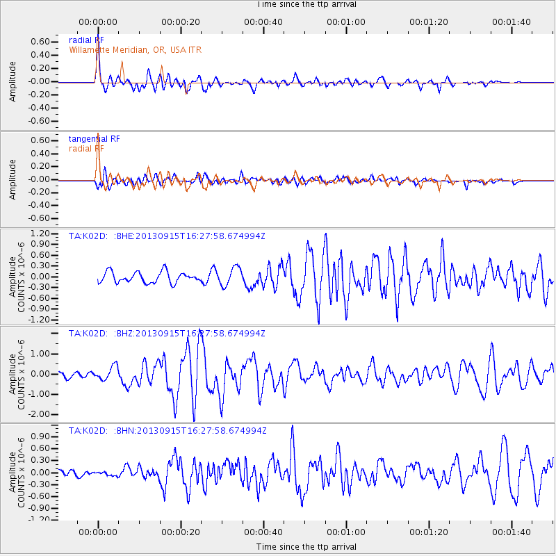
Signal To Noise
| Channel | StoN | STA | LTA |
| TA:K02D: :BHZ:20130915T16:27:58.674994Z | 2.5475428 | 3.446497E-7 | 1.3528711E-7 |
| TA:K02D: :BHN:20130915T16:27:58.674994Z | 0.5955625 | 5.3051824E-8 | 8.907851E-8 |
| TA:K02D: :BHE:20130915T16:27:58.674994Z | 1.6776072 | 2.5124234E-7 | 1.4976233E-7 |
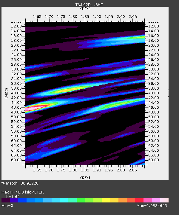
| Arrivals | |
| Ps | 4.9 SECOND |
| PpPs | 17 SECOND |
| PsPs/PpSs | 22 SECOND |

