K46A Dorr, MI, USA - Earthquake Result Viewer
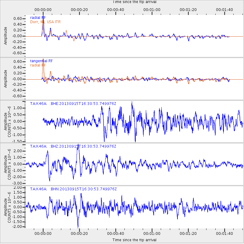
Earthquake location: Andreanof Islands, Aleutian Is.
Earthquake latitude/longitude: 51.6/-174.7
Earthquake time(UTC): 2013/09/15 (258) 16:21:37 GMT
Earthquake Depth: 24 km
Earthquake Magnitude: 6.1 MWW, 5.7 MI, 5.7 ML, 6.0 MWB, 6.1 MWC, 6.1 MWW
Earthquake Catalog/Contributor: NEIC PDE/NEIC COMCAT
Network: TA USArray Transportable Network (new EarthScope stations)
Station: K46A Dorr, MI, USA
Lat/Lon: 42.69 N/85.78 W
Elevation: 213 m
Distance: 57.6 deg
Az: 60.87 deg
Baz: 312.328 deg
Ray Param: 0.06337972
Estimated Moho Depth: 26.5 km
Estimated Crust Vp/Vs: 1.99
Assumed Crust Vp: 6.483 km/s
Estimated Crust Vs: 3.254 km/s
Estimated Crust Poisson's Ratio: 0.33
Radial Match: 82.91702 %
Radial Bump: 400
Transverse Match: 61.263687 %
Transverse Bump: 400
SOD ConfigId: 626651
Insert Time: 2014-04-18 17:26:04.785 +0000
GWidth: 2.5
Max Bumps: 400
Tol: 0.001

Signal To Noise

ChannelStoNSTALTA
TA:K46A: :BHZ:20130915T16:30:53.749976Z6.81228161.2229667E-61.795238E-7
TA:K46A: :BHN:20130915T16:30:53.749976Z2.41360025.6023777E-72.3211705E-7
TA:K46A: :BHE:20130915T16:30:53.749976Z3.65823866.1402284E-71.6784658E-7
Arrivals
Ps4.2 SECOND
PpPs12 SECOND
PsPs/PpSs16 SECOND