
KMSC Kings Mountain, Blacksburg, SC, USA - Earthquake Result Viewer
| ||||||||||||||||||
| ||||||||||||||||||
| ||||||||||||||||||
|
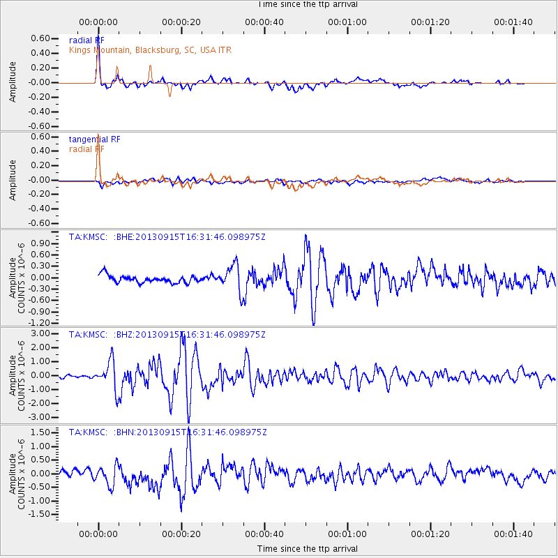
Signal To Noise
| Channel | StoN | STA | LTA |
| TA:KMSC: :BHZ:20130915T16:31:46.098975Z | 11.27982 | 1.0617958E-6 | 9.413233E-8 |
| TA:KMSC: :BHN:20130915T16:31:46.098975Z | 3.7179532 | 4.0976116E-7 | 1.1021149E-7 |
| TA:KMSC: :BHE:20130915T16:31:46.098975Z | 3.7200937 | 3.5973636E-7 | 9.670089E-8 |
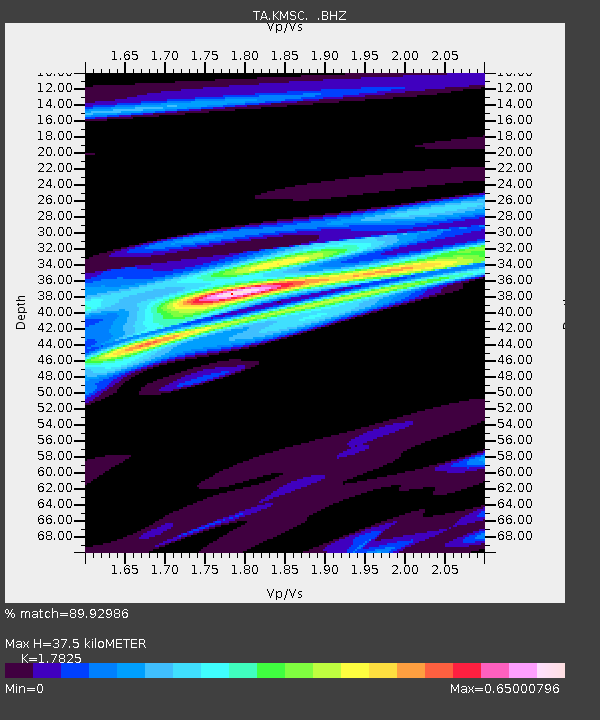
| Arrivals | |
| Ps | 4.8 SECOND |
| PpPs | 16 SECOND |
| PsPs/PpSs | 20 SECOND |

